
For the dedicated birder, the Pacific Northwest state of Oregon isn't just a destination—it's an essential pilgrimage. From the rugged Pacific coastline to the arid high desert, Oregon's remarkable tapestry of habitats hosts an astonishing 480+ bird species, solidifying its reputation as one of the best bird-watching regions in North America. This article invites you on a journey through the state's diverse biomes, revealing why Oregon's varied landscape—from the coastal cliffs where the iconic Tufted Puffin nests to the inland wetlands of Malheur National Wildlife Refuge, a critical stopover on the Pacific Flyway—offers unparalleled opportunities for observing both resident and migratory birds throughout the year.
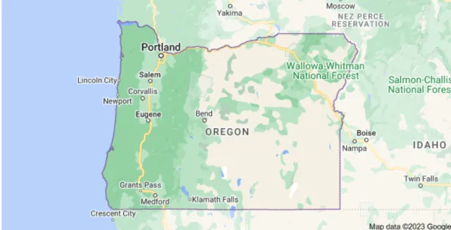
Whether you're tracking secretive forest dwellers like the Marbled Murrelet in old-growth coniferous woods, spotting raptors like the Bald Eagle soaring above the Cascades, or marveling at thousands of migrating waterfowl in the Klamath Basin, Oregon provides a spectacular and accessible experience for birders of all skill levels. Prepare your binoculars and field guide; the Beaver State is calling.
Hatfield Lake
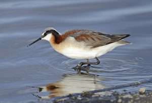
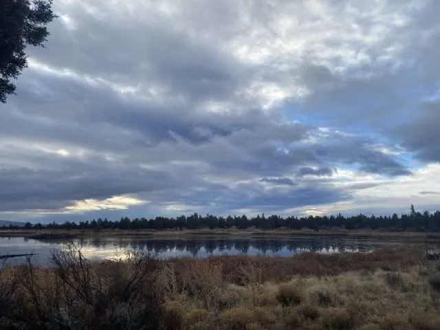
Hatfield Lake, often referred to locally as Hatfield Ponds, is a renowned birding hotspot located just east of Bend in Central Oregon's high desert country. Despite its unassuming identity as the city's water reclamation facility, its geography—a series of managed sewage lagoons—creates a vibrant oasis of open water and wetland habitat that sharply contrasts with the surrounding juniper and sagebrush steppe.
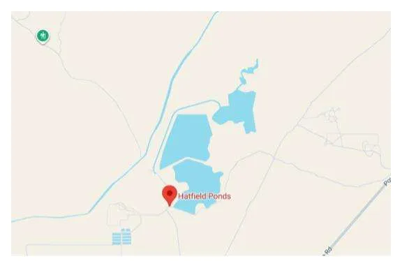
This unique, low-lying terrain, situated in Deschutes County, acts as an ecological magnet in an otherwise arid region. The flat topography and dike roads separating the various ponds make for easy, walk-in access, allowing birders to circumnavigate the wetlands and gain excellent, often elevated, views of the open water and mudflats. The majestic, snow-capped peaks of the Cascade Mountains provide a stunning backdrop, enhancing the experience of birding in this surprising corner of the desert.

This crucial patch of water in Central Oregon translates directly into exceptional bird-watching opportunities, particularly during the spring and fall migration periods. Hatfield Lake consistently boasts the broadest spectrum of waterfowl and shorebird species in the region, serving as a vital stopover on the Pacific Flyway. Over 200 species have been recorded here, including a remarkable list of rarities for the area.
Birders flock to the ponds to observe ducks and geese, such as Northern Pintail and Ring-necked Duck, as well as a diverse array of shorebirds like Long-billed Dowitchers and various migrating sandpipers, whose sightings are highly dependent on seasonal water level fluctuations that expose foraging mudflats. The emergent vegetation of cattails and bulrushes provides refuge for secretive species like the Virginia Rail and Sora, while the area's wealth of prey also attracts up to 15 species of raptors, including frequent sightings of Bald Eagles hunting over the water.
Target Birds
Cinnamon Teal
Black-necked Grebe
Sora
Ash-throated Flycatcher
Wilson's Phalarope
Pinyon Jay
The East Cascades Audubon Society has good information about access to the ponds and directions as well as access details.
Nehalem Bay State Park
Nehalem Bay State Park is a premier coastal birding destination on the North Oregon Coast, distinguished by its unique geography as a four-mile-long sand spit. This narrow peninsula is strategically positioned between the powerful Pacific Ocean to the west and the sheltered, tidal waters of Nehalem Bay to the east, creating an ecotone that supports an exceptional variety of avian life.
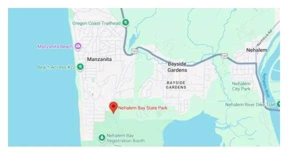
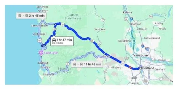
The park's interior is dominated by stabilizing Shore Pine and Sitka Spruce forest that gives way to rolling sand dunes and exposed tidal flats, offering birders a rare combination of ocean, estuary, and woodland habitats within a short walking distance. Its location, just south of the town of Manzanita and framed by the dramatic rise of Neahkahnie Mountain, makes it easily accessible via Highway 101, yet it feels wonderfully isolated, acting as a natural magnet for birds traveling the Pacific Flyway.
The diversity of habitats at Nehalem Bay provides excellent year-round bird watching opportunities, particularly for shorebirds and waterfowl. The expansive mudflats along the bayside are an ideal feeding and roosting area for migratory species, where birders can spot Gray Plovers, various sandpipers, and occasional Snowy Egrets.
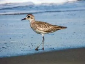
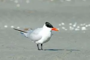
The ocean beach, however, is the prime location for observing federally threatened Western Snowy Plovers during their nesting season (March 15 - September 15), necessitating careful observation from the wet sand only. The forested dunes and campground areas attract songbirds and raptors, including resident Bald Eagles and summer nesting colonies of Purple Martins. For a deeper coastal experience, a walk to the North Jetty offers great views of rock-loving species like Black Turnstones and various sea ducks, rounding out a truly comprehensive Oregon coastal birding trip.
Target Birds
Rufous Hummingbird
Caspian Tern
Olive-sided Flycatcher
Hutton's Vireo
Chestnut-backed Chickadee
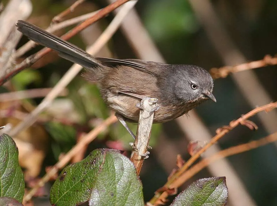
Wrentit
Western Gull
The Oregon State Parks webpage for Nehalem has good details about amenities in the area including camping facilities, permits and wildlife viewing opportunities.
Bayocean Spit
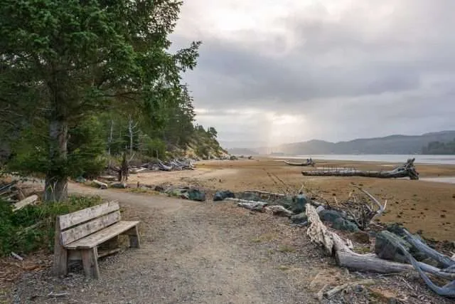
A world of contrasting coastal habitats awaits at Bayocean Spit, a dynamic and historically significant landform on the Oregon Coast. Located in Tillamook County, this long, narrow peninsula acts as a natural separator between the pounding surf of the Pacific Ocean to the west and the calmer, estuary waters of Tillamook Bay to the east.
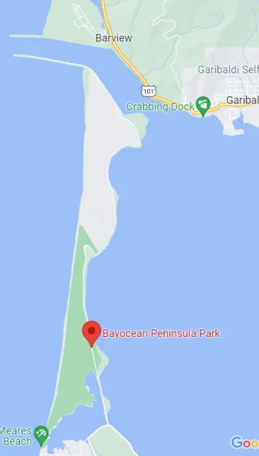
The Spit is a remarkable example of coastal geography, having been the site of the ambitious, yet ill-fated, resort town of Bay Ocean Park in the early 20th century, which ultimately succumbed to erosion before the Spit was artificially restored. Today, the geography of Bayocean offers a stunning and accessible range of environments, including vast sandy beaches, rolling grassy dunes, maritime shrub-scrub, and a freshwater lake (Cape Meares Lake), all within a short walk of each other. A non-motorized, nine-mile loop trail extends out to the tip of the peninsula, providing a comprehensive tour of this varied landscape.
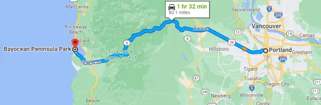
This confluence of environments makes Bayocean Spit an exceptional bird-watching destination, hosting a checklist of over 230 bird species. The Tillamook Bay side is particularly rich, with extensive mudflats that attract massive numbers of wintering waterfowl, including various scoters, goldeneyes, and Brant geese, as well as a plethora of migrating shorebirds like Gray Plovers, Whimbrels, and several species of sandpipers.
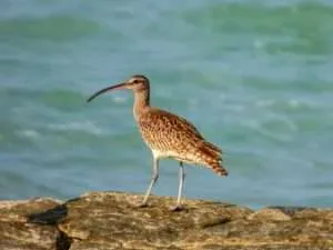
The ocean-facing beach offers a different experience, allowing for seawatching to spot pelagic species and providing nesting habitat for the threatened Western Snowy Plover. Furthermore, the wooded areas and dense willow patches act as a "migrant trap" during spring and fall, drawing in passerines like warblers and sparrows, while the whole area is patrolled by raptors such as the Bald Eagle and the swift Peregrine Falcon. Bayocean Spit is a rewarding site for birders seeking a high diversity of shorebirds, seabirds, and landbirds in a beautiful, ever-changing coastal setting.
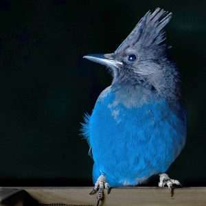
Target Birds
American White Pelican
Northern Harrier
Red-throated, Pacific and Great Northern Diver
Steller's Jay
Marsh Wren
Western Tanager
The ECAS gives access information as well as permit fees and likely bird sightings.
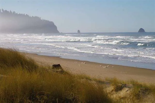
William L. Finley NWR
The William L. Finley National Wildlife Refuge (NWR) is a critical conservation area situated in the Willamette Valley of western Oregon, approximately ten miles south of Corvallis. Established in 1964, its primary purpose is to protect wintering habitat for the dusky Canada goose, a subspecies that winters almost exclusively in this valley after nesting on Alaska's Copper River Delta.
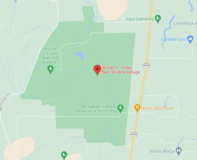
The 5,700-acre refuge's unique geography safeguards some of the valley's rarest historical habitats, including the largest remaining tract of native Willamette Valley wet prairie, along with expansive seasonal wetlands, Oregon white oak savannas, and riparian forests. This mix of lowlands and uplands, nestled between the Coast Range and the Cascade Mountains, is a remnant of the pre-settlement landscape, making it an invaluable ecological gem.
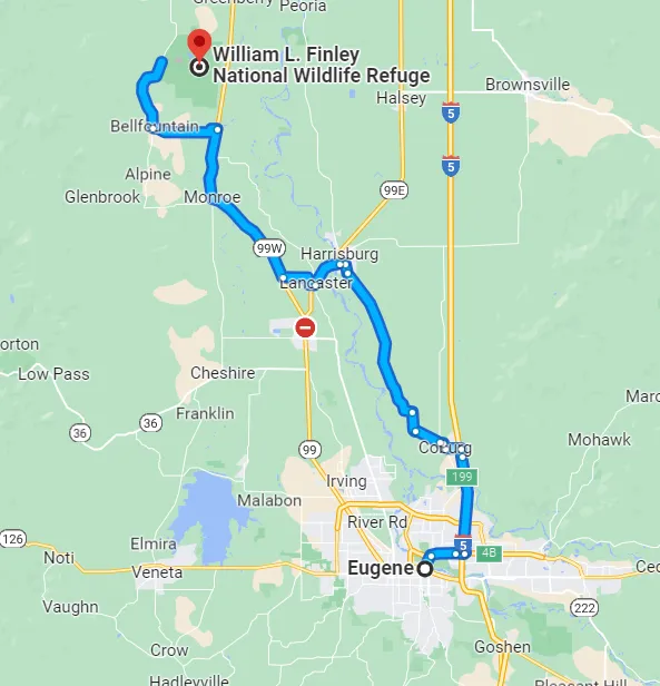
These diverse habitats translate into outstanding year-round bird watching opportunities, with over 260 bird species recorded at the refuge, which sits along the vital Pacific Flyway. Birding is excellent in the winter (November through March), when thousands of migratory waterfowl, including ducks, geese, and Tundra Swans, arrive to rest and forage in the protected wetlands and agricultural fields.
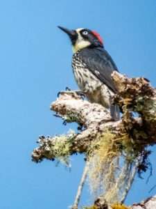
While most wetland areas are closed during this time to prevent disturbance, birders can still observe the massive flocks and their associated raptors, like Bald Eagles and Northern Harriers, from the public roads, viewing blinds, and all-season trails like the Homer Campbell Boardwalk. In the spring and summer, the focus shifts to the upland areas, where species like the Acorn Woodpecker, Western Bluebird, Horned Lark, and various warblers thrive in the oak savannas and native wet prairies.
Target Birds
Bewick's and Marsh Wren
Acorn Woodpecker
Warbling Vireo
California Scrub-Jay
Western Bluebird
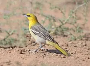
Bullock's Oriole
The U.S. Fish and Wildlife Service has a webpage for the NWR and it describes the area in detail with good visitor information.
Klamath Bird Observatory
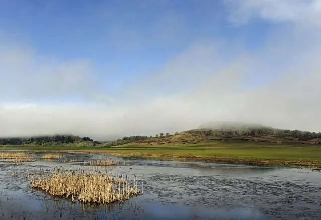
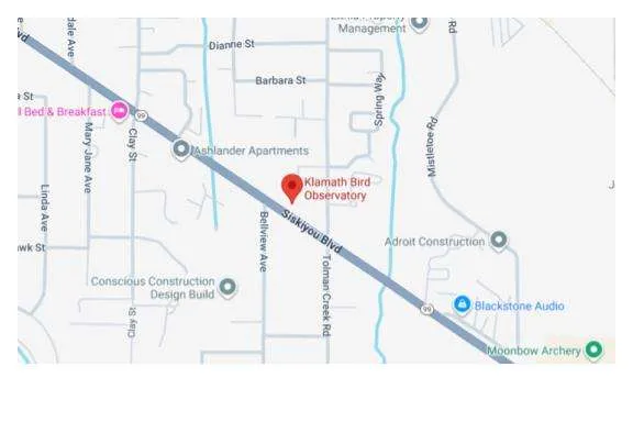
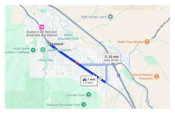
The Klamath Bird Observatory (KBO) is not a single public park but a pivotal scientific organization whose research and conservation efforts are centered in one of North America's most ecologically significant regions: the vast Klamath-Siskiyou Bioregion of Southern Oregon and Northern California. Geographically, this area is a complex convergence zone where the Cascade, Coast, and Siskiyou mountain ranges meet the arid high desert of the Great Basin.
This unique geology and climate create an incredible diversity of habitats, including expansive wetlands, mixed-conifer and oak-chaparral forests, and riparian corridors along major waterways like the Rogue and Klamath Rivers. KBO uses this exceptional natural laboratory—from the Rogue Valley's oak woodlands to the high-elevation forests of Crater Lake National Park—to conduct long-term bird monitoring, making the entire bioregion an area of high importance for bird study.
The resulting bird-watching opportunities within the KBO's region of influence are spectacular, attracting birders from around the globe. The numerous monitoring and banding stations, while primarily for scientific research, often offer community education and guided experiences. This entire area is a critical component of the Pacific Flyway, meaning the birdlife is dynamic and rich year-round.
In the extensive wetlands of the Klamath Basin National Wildlife Refuges, you can observe massive concentrations of migrating waterfowl and American White Pelicans, while the winter brings the largest concentration of Bald Eagles in the lower 48 states. Additionally, the region is a stronghold for specialist species like the Lewis's Woodpecker and Oregon Vesper Sparrow, making the trails and forests here an essential stop for anyone wishing to observe a cross-section of Western North American avian life.
Target Birds
Yellow-headed Blackbird
Clark's Grebe
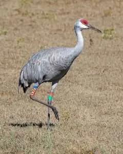
Sandhill Crane
Osprey
Western Kingbird
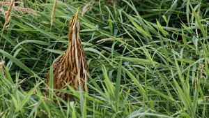
American Bittern
The Klamath Bird Observatory has information for visitors and supporters of bird conservation in the areas.
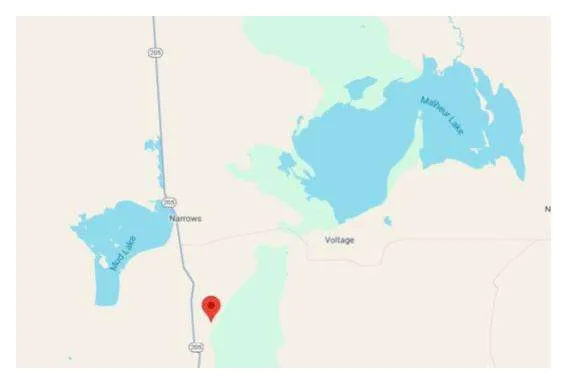
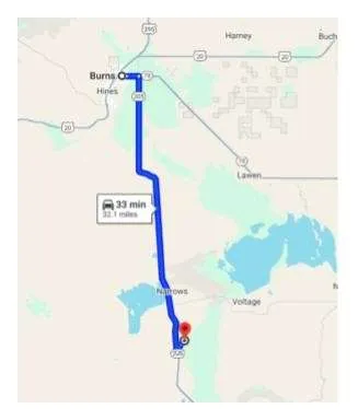
Malheur National Wildlife Refuge
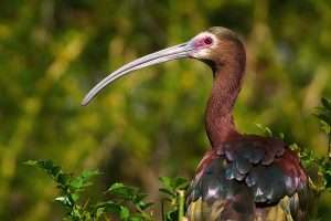
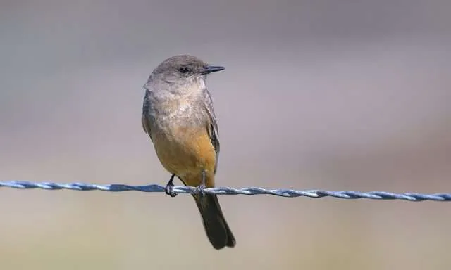
Target Birds
Long-billed Curlew
Forster's Tern
Black-billed Magpie
Bobolink
Say's Phoebe
MacGillivray's Warbler
The USFWS website has visitor information including details about the Visitor Center.
Read our editorial on how birding saved a life.
Baskett Slough National Wildlife Refuge
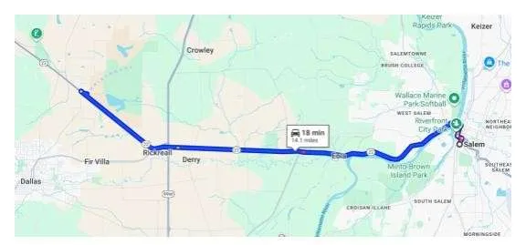
Located approximately ten miles west of Salem in Oregon's fertile Willamette Valley, Baskett Slough National Wildlife Refuge is a critical conservation area managed primarily to provide vital wintering habitat for the threatened Dusky Canada Goose. The refuge's 2,500 acres feature a diverse geography of rolling, oak-covered uplands—including Baskett Butte—and extensive low-lying areas encompassing seasonal wetlands, permanent open water, grasslands, and cultivated farmlands.
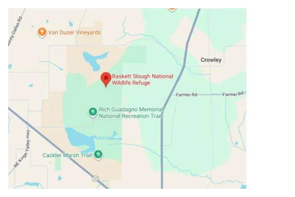
This rich mix of habitats, set against the backdrop of the eastern foothills of the Coast Range, supports a high level of biodiversity, including the largest remaining population of the endangered Fender's Blue Butterfly and a recorded list of over 250 bird species.
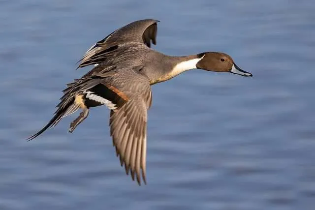
Baskett Slough offers exceptional year-round bird watching, though the experience dramatically shifts with the seasons. In winter (October through March), the refuge's primary function as a sanctuary for migratory waterfowl takes center stage, with thousands of Canada Geese, various ducks (like Northern Pintails and Cinnamon Teals), and Tundra Swans congregating on the flooded wetlands and managed crop fields.
For this reason, much of the interior marsh is closed to public entry, but excellent views of these massive flocks and the raptors that hunt them—including Bald Eagles, Red-tailed Hawks, and Short-eared Owls—can be had from the viewing kiosk on Highway 22 and the year-round Rich Guadagno Memorial Loop Trail up Baskett Butte. In the spring and summer, when the seasonal trails re-open, birders can explore the oak woodlands for species like the Acorn Woodpecker and Western Bluebird, while also searching the grasslands for the federally protected Streaked Horned Lark.
Target Birds
Green Heron
Violet-green Swallow
Brewer's Blackbird
Shore Lark
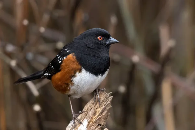
Spotted Towhee
Black-headed Grosbeak
Lazuli Bunting
The USFWS webpage details access to the refuge for visitors.
Crater Lake National Park
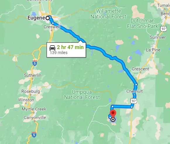
Crater Lake National Park is situated on the crest of the Cascade Mountain Range in Southern Oregon, an exceptional geographic location that heavily dictates its habitat and birdlife. The park's main feature is the stunning, deep-blue Crater Lake, which fills a massive caldera formed by the eruption and collapse of Mount Mazama approximately 7,700 years ago.
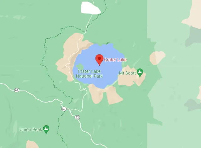
At an elevation that ranges from 4,000 to over 8,900 feet at Mount Scott, the geography is dominated by high-altitude, volcanic landscapes and expansive tracts of old-growth forest, primarily lodgepole and mountain hemlock. This high-elevation environment results in long, snow-heavy winters that restrict road access and shape the park's biodiversity, making the late spring and summer months the prime time for birding.
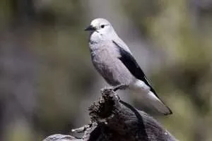
The park's challenging environment, particularly the high elevation and deep snowpack, attracts a specialized suite of avian residents and summer migrants. Birding opportunities here are unique, ranging from the open, rocky slopes of the caldera rim to the dense subalpine forests and meadows. Along the cliffs of the caldera, patient observers can spot impressive raptors such as Bald Eagles and Peregrine Falcons nesting, while the friendly and opportunistic Clark's Nutcracker and Gray Jay are commonly seen near Rim Village and overlooks.
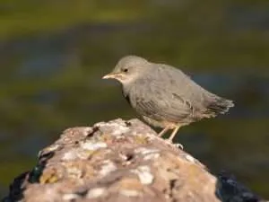
In the forested areas, a keen ear can help locate species like the Pileated and Black-backed Woodpeckers, while a trek into the subalpine meadows may reward a birder with a sighting of the high-elevation specialist, the Gray-crowned Rosy-Finch. Furthermore, the streams and creeks outside the immediate caldera, such as Annie Creek, are excellent locations to observe the unique aquatic songbird, the American Dipper.
Target Birds
Clark's Nutcracker
Townsend's Solitaire
Canada Jay
Black-backed Woodpecker
Cassin's Finch
Mountain Bluebird
The lakes are closed at times during the winter due to snow. The National Park Service website will give you the details you need to plan a warmer visit.

Fort Stevens
Located on the northernmost stretch of the Oregon Coast, Fort Stevens State Park offers a unique geographic convergence that makes it an exceptional birding hotspot. Situated on a peninsula at the mouth of the Columbia River where it spills into the Pacific Ocean, the park's 4,300 acres boast an incredibly diverse range of habitats.
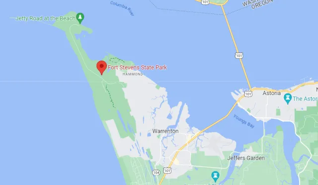
This dynamic geography includes vast sandy beaches, the rocky South Jetty which extends into the sea, thick spruce and hemlock forests, freshwater wetlands, deflation-plain marshes, and the tranquility of Coffenbury Lake. This mix of saltwater and freshwater ecosystems, along with maritime forest and open sand dunes, creates an ideal environment to support a year-round population of coastal birds and serve as a crucial staging area for migrants traveling along the Pacific Flyway.
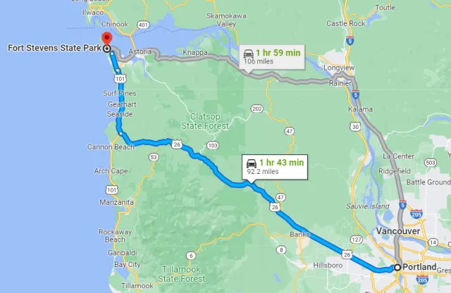
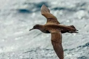
The sheer variety of avian life to be found at Fort Stevens provides spectacular bird-watching throughout all seasons. The South Jetty and the Trestle Bay area are renowned locations for observing thousands of migrating shorebirds in spring and fall, including Western Sandpipers, Dunlin, and Semipalmated Plovers. Seawatching from the observation tower on the jetty can yield sightings of open-ocean species like Sooty Shearwater, multiple species of loons and grebes, and various scoters.
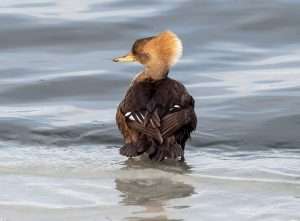
Inland, the freshwater marshes and Coffenbury Lake are home to breeding waterfowl like Wood Ducks and Hooded Mergansers, while the forests offer glimpses of woodland species like the Wrentit, Western Tanager, and various warblers. The presence of apex predators like the Bald Eagle year-round only adds to the excitement of this historically significant and ecologically vibrant park.
Target Birds
Snowy and Semipalmated Plover
Cedar Waxwing
Band-tailed Pigeon
Vaux's Swift
Anna's and Rufous Hummingbird
Hutton's and Warbling Vireo
The Oregon.gov has advice for visitors including camping facilities and recreational activities.

Summer Lake Wildlife Area
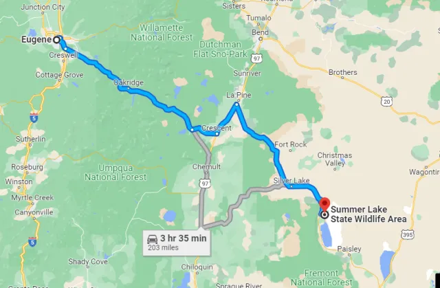
Tucked into the northwestern edge of the Great Basin in south-central Oregon, the Summer Lake Wildlife Area is a crucial 18,941-acre mosaic of wetlands, meadows, and arid high desert. This unique geography is dominated by the shallow, alkaline Summer Lake and the spring-fed Ana River, which meanders through the marshland, creating critical freshwater impoundments.
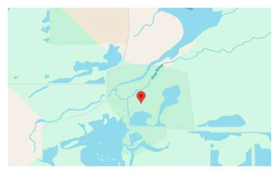
Positioned along the vital Pacific Flyway, the area acts as a life-sustaining oasis within a high desert landscape, making it an essential stopover point for hundreds of thousands of migratory waterfowl and shorebirds traveling between North and South America each spring and fall. The stunning contrast between the rugged, timber-covered Winter Ridge to the west and the expansive, often-dry lakebed to the south provides a dramatic backdrop for wildlife observation.
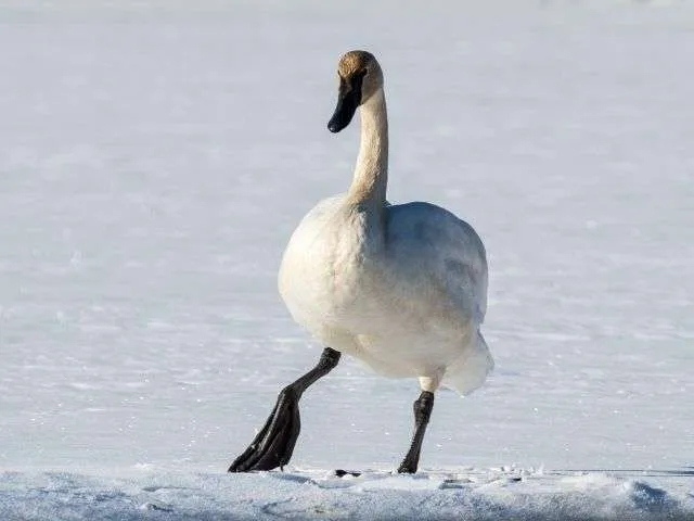
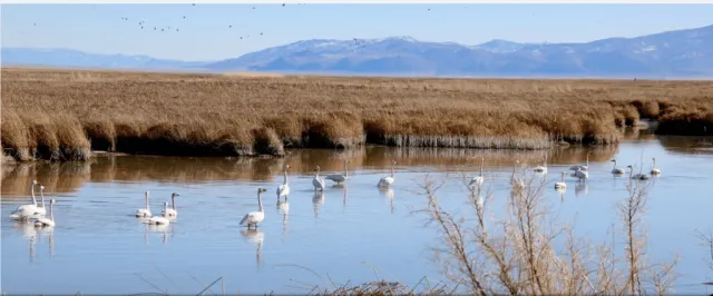
This distinctive concentration of diverse habitats translates into extraordinary bird-watching opportunities. Summer Lake is celebrated as one of Oregon's premier inland birding locations, boasting a recorded list of over 250 species. Birders flock here to witness massive seasonal concentrations of waterfowl, including numerous duck species, Canada Geese, and majestic Tundra and Trumpeter Swans. Shorebirds are equally abundant, with nesting species like the American Avocet, Black-necked Stilt, and Snowy Plover drawing enthusiasts.
The site's diverse environment also supports numerous raptors, such as Northern Harriers and Bald Eagles, as well as a variety of passerines, including the vibrant Yellow-headed Blackbird and marsh residents like the American Bittern and Virginia Rail. An 8.3-mile auto tour route allows visitors to traverse the area's rich ecosystems and view the spectacular avian action from the convenience of their vehicles.
Target Birds
Trumpeter Swan
Lesser Scaup
Virginia Rail
Black-necked Stilt
American Avocet
Black-crowned Night Heron
The Oregon Department of Fish and Wildlife has a comprehensive guide for visitors including parking fees and potential birds.
Wrapping Up
Oregon stands as an undisputed haven for bird watching, a title earned by its staggering geographical diversity—from the rugged Pacific Coast and high-elevation Cascades to the vast, arid wetlands of the Great Basin. This incredible range of ecosystems provides a year-round spectacle, supporting nearly 500 species, including charismatic seabirds, migratory waterfowl traveling the Pacific Flyway, and rare high-desert denizens.
The state's commitment to conservation, highlighted by its extensive network of Wildlife Areas, National Wildlife Refuges like Summer Lake and Malheur, and the organized Oregon Birding Trails, makes the experience accessible and rewarding for birders of all skill levels.
To continue enjoying this natural wealth, visitors are encouraged to practice responsible birding ethics, support local conservation efforts, and recognize that their observations contribute valuable data to the ongoing stewardship of these irreplaceable habitats. In Oregon, every field trip offers not just a view of magnificent birds, but a profound connection to the delicate balance of the natural world.
Want more? Read our birding locations of Wyoming.
