
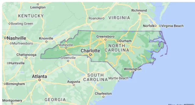
North Carolina is a phenomenal birdwatching destination, offering a spectacular array of avian life driven by its unique geography that spans three distinct eco-regions: the dramatic Appalachian Mountains, the rolling Piedmont plateau, and the dynamic Coastal Plain. This diversity ensures that birders can encounter everything from high-altitude breeding warblers to immense concentrations of shorebirds and waterfowl. Positioned perfectly on the Atlantic Flyway, the state funnels millions of migrants through its borders each spring and fall, solidifying its reputation as a crucial avian crossroads.
This ecological breadth is perfectly illustrated by two of the state's prime birding locations, representing the contrasting habitats: Airlie Gardens and the Pea Island National Wildlife Refuge (NWR). In the southeastern coastal city of Wilmington, Airlie Gardens provides a lush, managed sanctuary that acts as a migrant trap, drawing in neotropical songbirds like warblers and vireos as they encounter the first major land barrier after crossing the Atlantic. Further north along the Outer Banks, Pea Island NWR is an internationally significant coastal wetland and barrier island system. Its lagoons and marshes are critical wintering grounds and staging areas for massive numbers of waterfowl, including tundra swans and snow geese, alongside a vast range of shorebirds and wading birds, offering unparalleled opportunities for viewing large concentrations of species. Whether you are searching for a tiny, dazzling migrant or a grand, coastal spectacle, North Carolina provides an essential and rewarding experience for every birder.
Pea Island NWR
The Pea Island National Wildlife Refuge (NWR) is a critical coastal sanctuary located on the northern end of Hatteras Island, a low-lying barrier island that forms part of North Carolina's famous Outer Banks. The refuge extends for 13 miles and is geographically defined by its long, narrow strip of land separating the turbulent Atlantic Ocean on the east from the calmer, shallow waters of Pamlico Sound on the west.
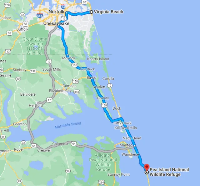
This geography creates a unique dynamic, where ocean beaches, dunes, and maritime forests meet extensive salt marshes, brackish ponds, and mudflats facing the sound. The low elevation and dynamic nature of the barrier island mean the refuge is constantly being reshaped by wind and water, resulting in varied and productive habitats that are essential to avian life along the Atlantic Flyway.
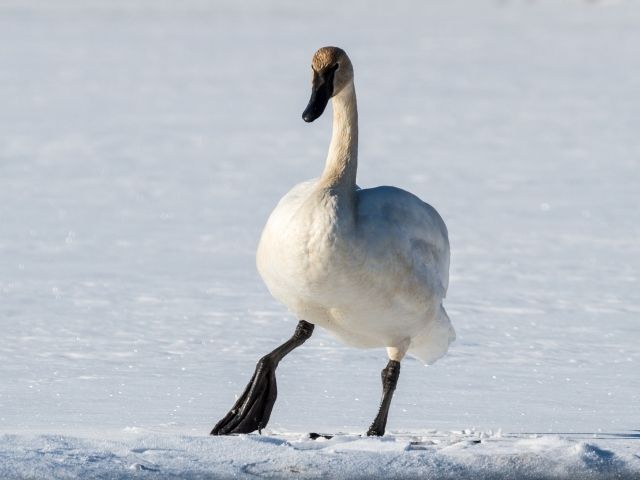
Pea Island NWR is globally recognized as one of the most important birdwatching destinations on the East Coast, with over 365 species recorded. Its primary role is to serve as a major wintering ground and staging area for migratory waterfowl. During the cooler months (October through March), birders can witness immense concentrations of ducks, geese, and swans, including thousands of Tundra Swans, Snow Geese, and various dabbling ducks.
The refuge's numerous managed impoundments and mudflats are crucial for shorebirds during migration, attracting sandpipers, plovers, and willets. Meanwhile, the ocean-facing side provides opportunities to spot seabirds, and the dense marsh vegetation harbors wading birds like Great Egrets and herons. The refuge offers an accessible 4-mile wildlife drive and several walking trails, ensuring excellent visibility for viewing the sheer abundance of coastal avian life.
Target Birds
American Oystercatcher
Gray Plover
White-rumped and Semipalmated Sandpiper
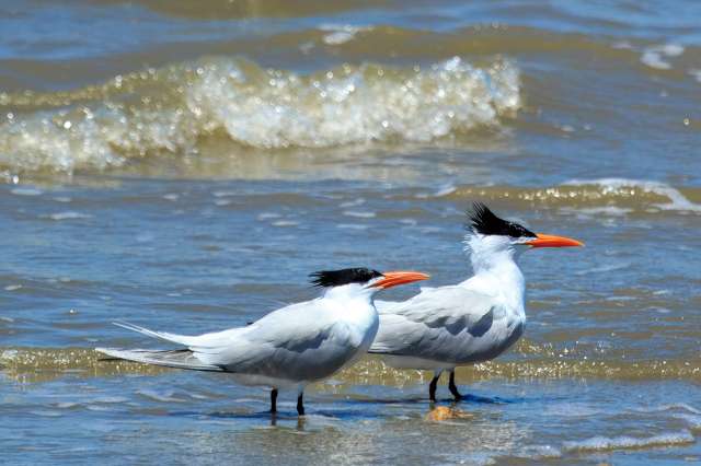
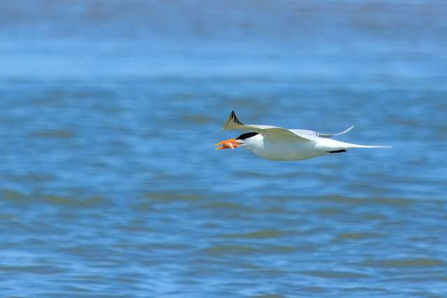
Least and Royal Tern
Tricolored Heron
American Avocet
Clapper Rail
The U.S. Fish and Wildlife Service has information about access, birds present and any closures. It also gives details about the Visitor Center.
Alligator River NWR
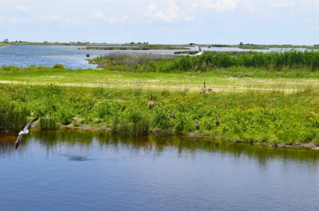
Alligator River National Wildlife Refuge (NWR) is a massive protected area situated on the Albemarle-Pamlico Peninsula in eastern North Carolina, directly west of the popular Outer Banks. Encompassing over 152,000 acres, the refuge is defined by a unique and challenging ecological landscape known as pocosin, a local term for the extensive, peat-based swamp characterized by dense, often stunted evergreen shrub-bog forests. The refuge's geography is a complex mix of these acidic freshwater wetlands, dense mixed-pine and hardwood uplands, and brackish coastal estuaries, all crucial elements of the state's Coastal Plain.
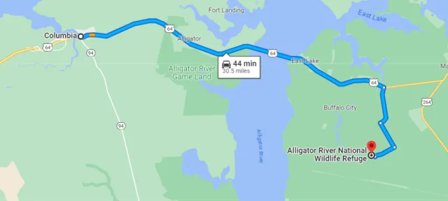
This isolation and the extensive wilderness not only serve as a key habitat for larger wildlife, such as the American Alligator and one of the densest populations of Black Bears in the eastern U.S., but also create an irreplaceable protected staging and nesting ground for a wide array of avian life along the Atlantic Flyway.
The ecological diversity of Alligator River NWR translates into rich and varied birdwatching opportunities throughout the year. The dense pocosin and upland forests are critical habitats for neotropical songbirds, offering excellent views of various warblers and vireos during their spring and fall migrations.
In the winter, the managed wetlands and open water attract significant numbers of waterfowl, including various species of ducks and occasional large flocks of Tundra Swans that utilize the refuge as a vital wintering ground. Raptors are also a major draw, with year-round sightings of Osprey and Bald Eagles common along the waterways and open fields. For birders, the refuge’s extensive network of dirt roads and public access areas, such as the well-known Buffalo City Road, provides ideal viewing platforms to scan the open pocosin and discover both the area's iconic coastal birds and its more elusive, forest-dwelling species.

Target Birds
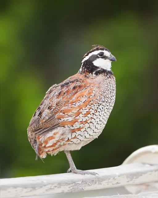
Northern Bobwhite
Yellow-billed Cuckoo
Brown-headed Nuthatch
Ovenbird
Pine Warbler
Barred Owl
- Ovenbird
The State of North Carolina Parks has contact details for the refuge and other relevant information.
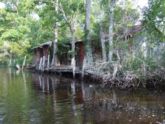
Mattamuskeet NWR
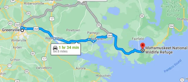
Mattamuskeet National Wildlife Refuge (NWR) is a critical coastal birding destination located in eastern North Carolina, roughly halfway down the state's Atlantic coastline near the Pamlico Sound. Its geography is dominated by Lake Mattamuskeet, North Carolina's largest natural lake, which is unusually shallow, vast, and non-tidal. The refuge encompasses the entire 40,000-acre lake and an additional 10,000 acres of surrounding marsh, forest, and impoundments.
This low-lying area is part of the extensive Coastal Plain, characterized by its fertile, dark soils and proximity to the larger Pamlico Sound, creating a unique hydrological system that supports a massive, nutrient-rich shallow water habitat for aquatic vegetation. The refuge's management focuses on maintaining water levels to maximize food resources for migratory birds.
The primary birdwatching draw at Mattamuskeet NWR is the sheer number of wintering waterfowl, making it one of the most important wintering habitats on the Atlantic Flyway. From November through March, the refuge hosts tens of thousands of ducks, including Northern Pintails, Gadwalls, and Mallards, but is most famous for its immense congregations of Tundra Swans.
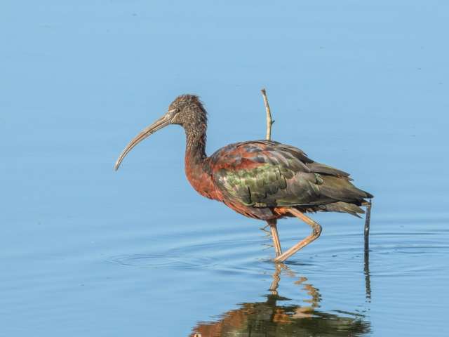
Birders can also find large numbers of Greater Snow Geese and various wading birds, such as Great Egrets and Glossy Ibises, that utilize the surrounding impoundments. The best viewing opportunities are found along the driving routes and from observation platforms overlooking the lake and managed moist-soil units. Additionally, the forested areas provide habitat for wintering sparrows and the impressive Bald Eagles and Ospreys that hunt over the productive waters.

Target Birds
Little Blue Heron
Blue Grosbeak
Greater Yellowlegs
Prothonotary Warbler
American Black Vulture
Anhinga
The USFWS has good advice for visitors to ensure their safety. This website is a good place to start.
Cape Hatteras NS
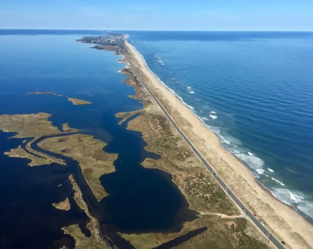
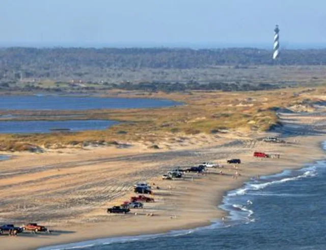
Cape Hatteras National Seashore (NS) is a dynamic, 70-mile stretch of barrier islands in the Outer Banks of North Carolina, running from South Nags Head to Ocracoke Inlet. Geographically, it is a narrow, low-lying coastal landscape defined by shifting sand dunes, maritime forests, salt marshes, and tidal flats. Its most critical feature is its location: the Outer Banks jut far out into the Atlantic Ocean, making it the first significant landmass encountered by birds migrating north along the Atlantic Flyway and the last they see heading south.
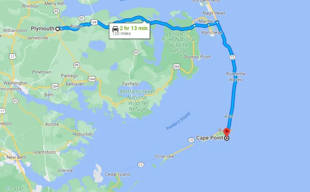
Furthermore, the convergence of the cold Labrador Current and the warm Gulf Stream offshore creates nutrient-rich waters that support massive fish populations, which in turn attract large numbers of pelagic (open ocean) and coastal birds.
Cape Hatteras NS is widely regarded as one of the premier birding destinations on the East Coast, offering exceptional opportunities across all seasons. During spring and fall migration, the area acts as a migrant trap, concentrating vast numbers of shorebirds, waterfowl, and passerines (songbirds) that pause to refuel on the rich mudflats and in the shrub thickets before continuing their journeys.

The coastal ponds and marshes, like those accessible from the Oregon Inlet area, are magnets for wintering ducks and geese, including Tundra Swans and various diving ducks. The area is perhaps most famous for its shorebirds, hosting species like Piping Plovers and American Oystercatchers. Additionally, the proximity to deep ocean waters means the area is a launch point for pelagic birding trips, where observers can seek true ocean wanderers such as shearwaters, storm-petrels, and jaegers that rarely come close to shore.
Target Birds
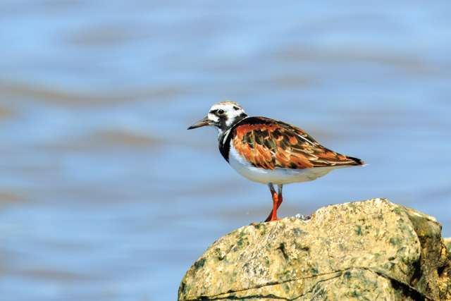
Ruddy Turnstone
Sanderling
Royal and Sandwich Tern
Lesser and Great Black-backed Gull
Wilson's Storm Petrel
Piping Plover
Least Bittern
The National Park Service has information for a range of activities including camping, recreation and birding.
Fort Fisher SRA
Fort Fisher State Recreation Area (SRA) is a unique coastal park located on the southern tip of Pleasure Island in New Hanover County, North Carolina, just south of Kure Beach and across the Cape Fear River from Southport. Geographically, the site is defined by its exposed position at the confluence of the Cape Fear River and the Atlantic Ocean. The area encompasses a highly dynamic mix of habitats critical to birdlife, including three distinct miles of undeveloped beach strand, rare maritime forest remnants, and extensive salt marsh behind the dunes.
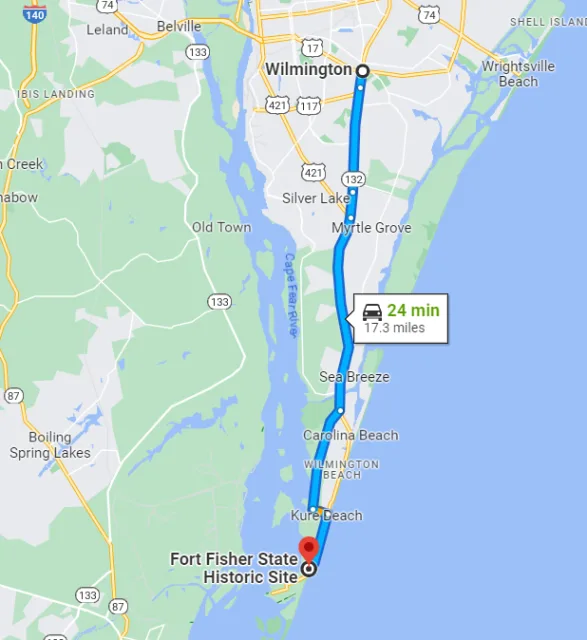
This barrier peninsula is highly susceptible to coastal processes, with constantly shifting sands, dunes stabilized by sea oats, and estuarine waters that create rich feeding grounds. Its position makes it a vital ecological boundary where river, ocean, and coastal marsh environments meet.
The diverse coastal and estuarine habitats at Fort Fisher SRA make it a prime location for viewing shorebirds, seabirds, and wading birds year-round, with peak activity during migration. The mudflats and spartina grasses of the marsh areas provide essential foraging habitat for species like Willets, Clapper Rails, and large flocks of wintering American Avocets and Dunlin.
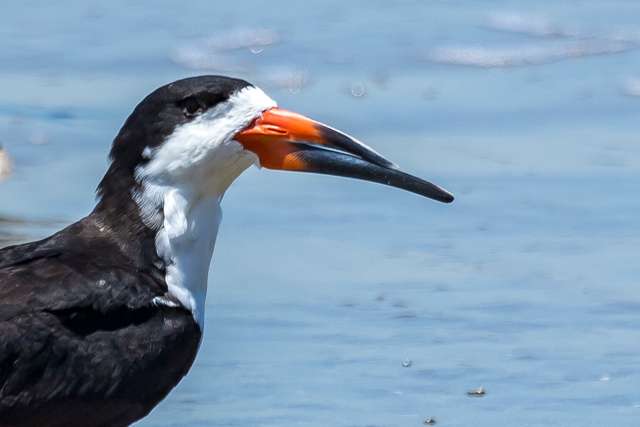
Along the oceanfront, visitors can often spot several species of Terns (such as Least, Royal, and Sandwich), Black Skimmers resting on the beach, and the elusive Piping Plover—a federally protected species—foraging in the swash zone. The maritime forest fragments, though small, act as a crucial migrant trap for exhausted songbirds arriving from the Atlantic crossing in spring. The park also hosts a significant nesting colony of Least Terns, making it a critical site for coastal bird conservation in North Carolina.

Target Birds
Willet
Laughing, Ring-billed and Herring Gull
Black Skimmer
Double-crested Cormorant
Osprey
Painted Bunting
Common Nighthawk
North Carolina Parks has visitor information and access details.
Lake Crabtree County Park
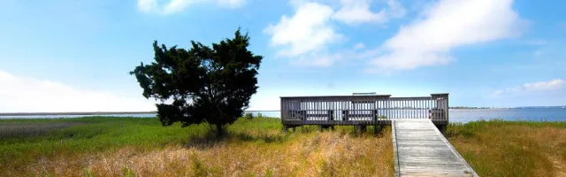
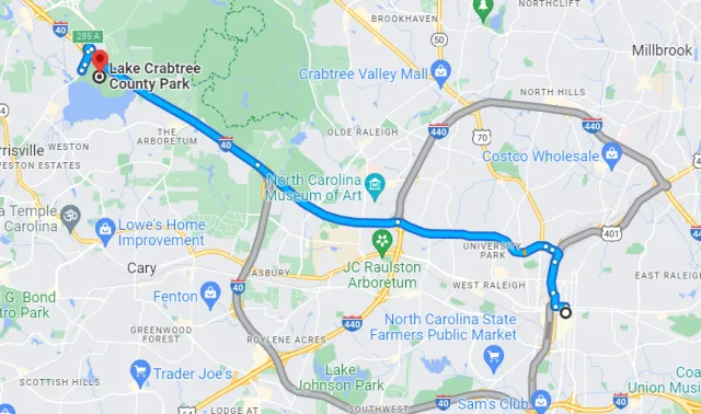
Lake Crabtree County Park is a popular 236-acre recreational area located in Wake County, North Carolina, situated immediately adjacent to Raleigh-Durham International Airport (RDU) and bordered by the Interstate 40 corridor. The park's central feature is the 1500-acre Lake Crabtree, a reservoir created in 1957 by impounding Crabtree Creek. Geographically, the park sits within the Piedmont plateau region, characterized by rolling hills, hardwood forests, and bottomland areas along the creek.
The immediate park area is defined by the mixed habitat of its shoreline, including mature upland mixed pine and hardwood forest, dense brush, and open water, creating diverse ecological niches right in the middle of a heavily developed urban area.
Despite its proximity to a major airport and highway, Lake Crabtree offers excellent and accessible birdwatching, particularly due to the extensive shoreline and varied forest cover that acts as a refuge. Over 200 bird species have been recorded here, with the lake itself serving as a major attractant for waterfowl and wading birds during migration and winter.
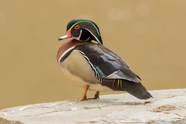
Visitors frequently spot species such as Wood Ducks, Pied-billed Grebes, and various gulls and terns on the open water. The surrounding trails and wooded areas are prime locations for observing a wide variety of songbirds, including numerous warblers and vireos during the spring and fall migrations along the Atlantic Flyway. Resident species like Northern Cardinals, Carolina Chickadees, and Red-shouldered Hawks are common year-round, making it a reliable birding destination close to the Raleigh-Durham metropolitan area.

Target Birds
Killdeer
Red-shouldered Hawk
Summer Tanager
Indigo Bunting
Yellow-throated and Red-eyed Vireo
Belted Kingfisher
Acadian Flycatcher
The Carolina Bird Club has excellent resources specifically for bird watchers.
Airlie Gardens
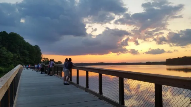
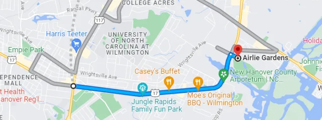
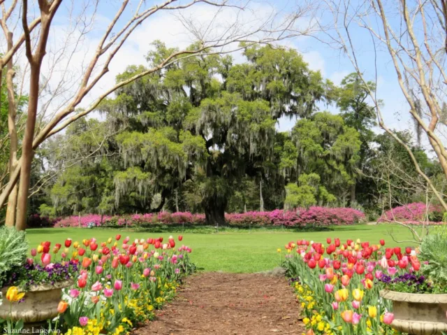
Airlie Gardens is a historic and beautifully maintained public garden situated in Wilmington, North Carolina, placing it squarely within the state's Coastal Plain region and just a few miles inland from the Atlantic Ocean. Its geography is defined by its rich, moist setting near the Intracoastal Waterway and its transition from high ground to freshwater ponds and tidal salt marshes.
The 67 acres feature diverse managed habitats, including ancient live oaks draped in Spanish moss (one dating back to 1545), formal seasonal gardens, large open lawns, freshwater lakes, and wetlands. This concentration of varied habitat in a relatively small, protected urban area creates a vital ecological oasis, perfectly positioned to attract weary travelers along the coast.
The strategic location and rich flora of Airlie Gardens make it an exceptional migrant trap, attracting huge numbers of neotropical songbirds during the spring and fall migrations. After flying long distances across the ocean or the vast coastal plain, birds are drawn to the mature trees and dense understory for rest and reliable foraging.
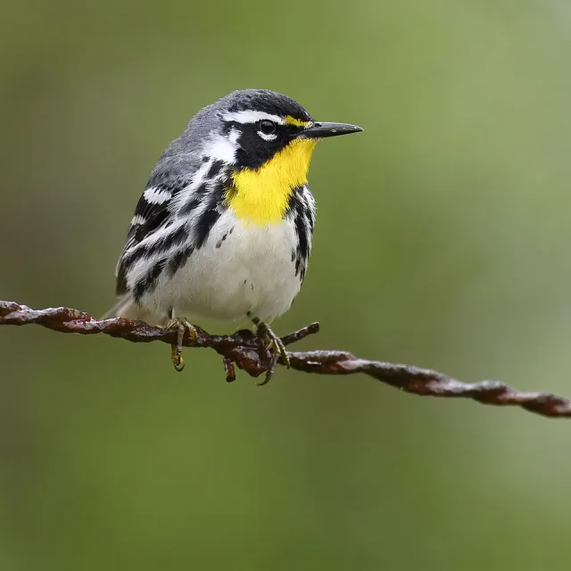
Birdwatchers can expect to see over 200 species throughout the year, with highlights including numerous species of warblers (such as Yellow-throated, Prothonotary, and Hooded), vireos, and tanagers during peak migration periods. The on-site freshwater ponds and adjacent marsh areas also attract wading birds like herons and egrets, as well as various species of ducks. Airlie's easy walking trails and controlled environment offer an accessible, high-density birding experience that complements the grander coastal spectacles found nearby.
Target Birds
Green Heron
Red-bellied Woodpecker
Fish Crow
Northern Parula
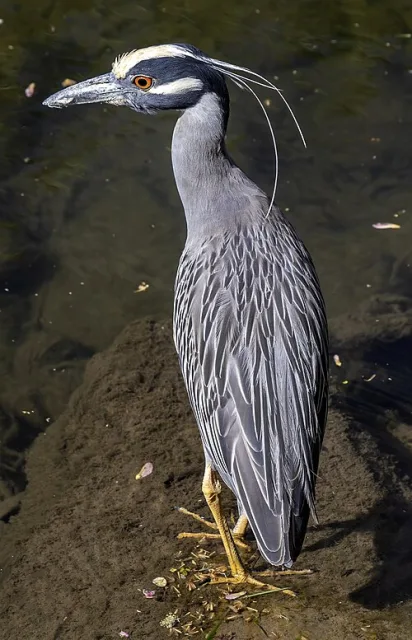
Yellow-crowned Night Heron
Mississippi Kite
The Airlie Gardens website has information for a range of visitors including birders. They regularly hold birding walks.
Bodie Island Lighthouse
The Bodie Island Lighthouse (pronounced "body") is located in Dare County, North Carolina, situated on the northern end of the Cape Hatteras National Seashore on the Outer Banks. Geographically, this area is defined by its dynamic barrier island ecosystem. Unlike a continental coastline, the Outer Banks consists of narrow, sandy islands that constantly shift with the forces of the Atlantic Ocean and the Currituck Sound.
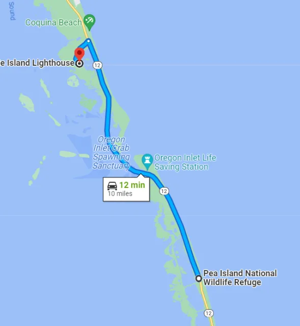
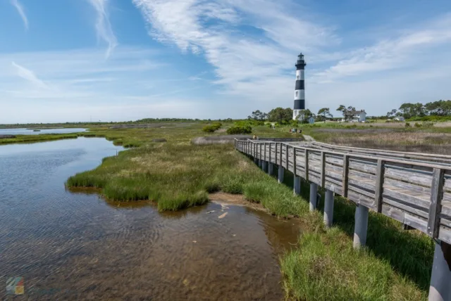
The lighthouse itself is nestled in a complex mosaic of habitats that include salt marshes, freshwater impoundments (managed wetlands), maritime thickets, and open stretches of sandy dune and beach. Its position at the junction of the sound and the ocean, combined with the presence of protected marshland directly west of the tower, makes it a critical, sheltered location for migrating and resident birdlife along this exposed coast.
The diverse habitat surrounding the Bodie Island Lighthouse offers exceptional birdwatching, making it a highly productive stop along the Atlantic Flyway. The most significant feature for birders is the extensive freshwater impoundment system just behind the lighthouse. These managed wetlands attract large numbers of waterfowl during the winter, including various species of ducks, geese, and Tundra Swans.
Wading birds like Great Egrets and Great Blue Herons are commonly seen year-round. The maritime thickets provide crucial cover and foraging for migrating passerines (songbirds), especially warblers and vireos, who use the barrier island as a vital refueling stop before or after crossing the open water. Birders can utilize the trail system around the base of the lighthouse and the overlooks near the impoundments to observe this rich mix of coastal, marsh, and woodland species.

Target Birds
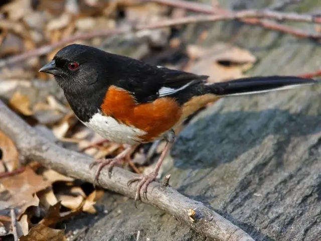
Eastern Towhee
Prairie Warbler
Great Northern Diver
Virginia Rail
Pied-billed Grebe
Seaside Sparrow
Chuck-will's-widow
The Outer Banks website has information about the area and the birding opportunities to be found here.
Holly Ridge WMA
Holly Ridge Wildlife Management Area (WMA) is situated in Pender County in the Coastal Plain region of southeastern North Carolina, just inland from the Atlantic Ocean and the New River. The WMA encompasses approximately 22,000 acres, which represents a crucial, preserved segment of the state's rare and imperiled longleaf pine ecosystem . Geographically, the terrain is characterized by flat, sandy soils, poorly drained wet pine savannas, and interspersed pocosin (a type of evergreen shrub bog) and bay forest areas.
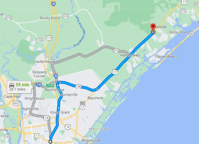
Much of the management is focused on maintaining this fire-dependent longleaf pine habitat through prescribed burns, which promotes the specialized understory of grasses and forbs essential to local wildlife. This unique combination of dry, open pine uplands and wet, shrubby bogs creates an ecological mosaic distinct from the coastal marshes.
Holly Ridge WMA is highly valued by birders for providing reliable opportunities to see several specialized and endangered southern pine species. The success of the prescribed burn program makes this one of the better locations to find the critically endangered Red-cockaded Woodpecker (RCW), a keystone species that relies exclusively on mature, living longleaf pines for nesting cavities.
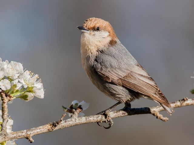
Birders also seek out other unique pine and grassland birds, including the Bachman's Sparrow and the Brown-headed Nuthatch. The mix of dense pocosin and upland scrub is also an excellent place to look for species like the Whip-poor-will and the Northern Bobwhite. The best birding often occurs near the pine-savanna interface, and visitors should plan to bird during the early morning hours, particularly during the spring and summer breeding seasons.

Target Birds
Red-cockaded Woodpecker
Brown-headed Nuthatch
Bachman's Sparrow
Blue Grosbeak
Eastern Meadowlark
Ovenbird
The Visit NC is a good place to start planning a visit to the WMA as there is hunting in the area at certain times.
Wrapping Up
In conclusion, North Carolina offers a truly comprehensive and rewarding birdwatching experience, driven by its exceptional geographic diversity. As a prime location on the Atlantic Flyway, the state's habitats range from the high-elevation peaks of the Appalachian Mountains, home to breeding neotropical migrants like the Cerulean Warbler, to the specialized, fire-maintained longleaf pine savannas of the Coastal Plain, like Holly Ridge WMA, which protect the endangered Red-cockaded Woodpecker.
The coastal regions—epitomized by the vital wetlands of Pea Island NWR and the sheltered migrant traps of Airlie Gardens—provide spectacular wintering grounds for immense flocks of waterfowl and offer reliable views of Atlantic shorebirds. Whether you are tracking the rare, endemic life of the pinelands or marveling at the sheer numbers of ocean-crossing migrants, North Carolina's blend of mountain, Piedmont, and coastal ecosystems ensures that every trip yields diverse, high-quality, and often surprising avian rewards. It is, without question, an essential state for any birder compiling a serious East Coast list.
Fascinating Facts About the Largest Birds in Every U.S. State
