
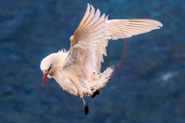
Hawaii, the isolated volcanic archipelago adrift in the central Pacific, presents one of the most unique and compelling birdwatching destinations on Earth. More than just a tropical paradise, the islands represent an extraordinary evolutionary laboratory, famed for their high degree of endemism—species found nowhere else in the world.
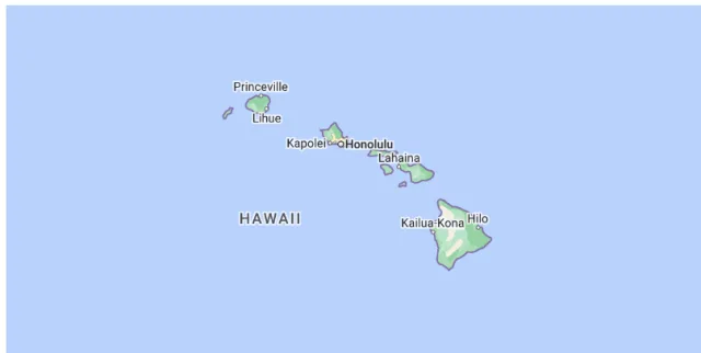
Birdwatching in Hawaii is a journey through biological history, offering a chance to glimpse the spectacular, and often fragile, results of millions of years of adaptation in isolation. While the islands face severe conservation challenges, particularly for their native forest birds, they remain home to resilient and beautiful species, from the vibrant, honeycreepers in the high-elevation ʻōhiʻa forests to the majestic seabirds that wheel over the open ocean. This guide explores the best opportunities to encounter the archipelago's avian marvels, highlighting the endemic treasures and the critical conservation efforts dedicated to preserving Hawaii's irreplaceable feathered heritage.
Kīlauea Point NWR
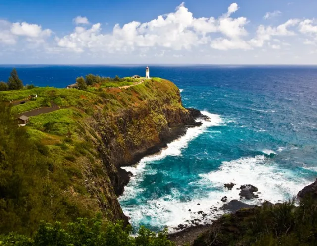
Kīlauea Point National Wildlife Refuge (NWR) is located on the northernmost tip of Kauaʻi, the oldest and fourth-largest of the main Hawaiian Islands. Geographically, the refuge is dominated by a dramatic volcanic headland that juts out into the Pacific Ocean, featuring steep, sheer cliffs rising hundreds of feet above the swirling ocean waters. The landscape is characterized by coastal scrub and native Hawaiian grasses that cling to the basalt rock, offering breathtaking panoramic views of the Pacific and the rugged north shore.
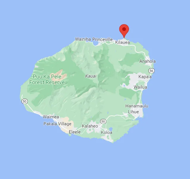
The most iconic feature is the historic Kīlauea Lighthouse, a sentinel built in 1913, which sits atop the bluffs and provides a perfect vantage point. This isolated, cliff-edge location makes the refuge a vital and protected nesting ground, as the steep cliffs deter most terrestrial predators, creating a safe haven for birds.
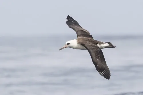
Kīlauea Point NWR offers some of the best, most accessible seabird viewing in the Hawaiian Islands. The refuge is an active nursery for several species of pelagic (open-ocean) birds that come ashore only to breed. Observers can easily spot the impressive Red-footed Booby (Sula sula) nesting in the naupaka bushes, the largest colony of this species on Kauaʻi. Another common sight is the stunning Laysan Albatross (Phoebastria immutabilis), which nests on the open ground close to the trails during the winter months, allowing close viewing of their majestic size and courtship dances.
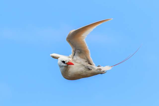
Other regular breeders and visitors include the dark Wedge-tailed Shearwater (Puffinus pacificus), the Great Frigatebird (Fregata minor) known for its massive wingspan and hooked bill, and the smaller Red-tailed Tropicbird (Phaethon rubricauda) with its distinctive long, streamer-like tail. The strong sea winds often bring the birds right overhead, providing excellent photographic and bird-watching opportunities.
Target Birds
White-tailed and Red-tailed Tropicbird
Warbling White-eye
Brown Booby
Black-footed Albatross
Erckel's Spurfowl
Short-eared Owl
The U.S. Fish and Wildlife Service has information about the refuge and the visitor center there.
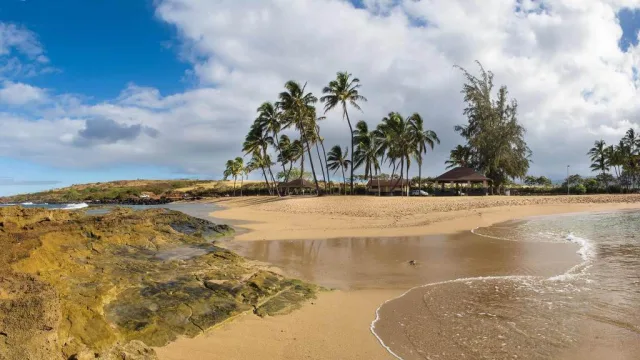
Salt Pond Beach Park
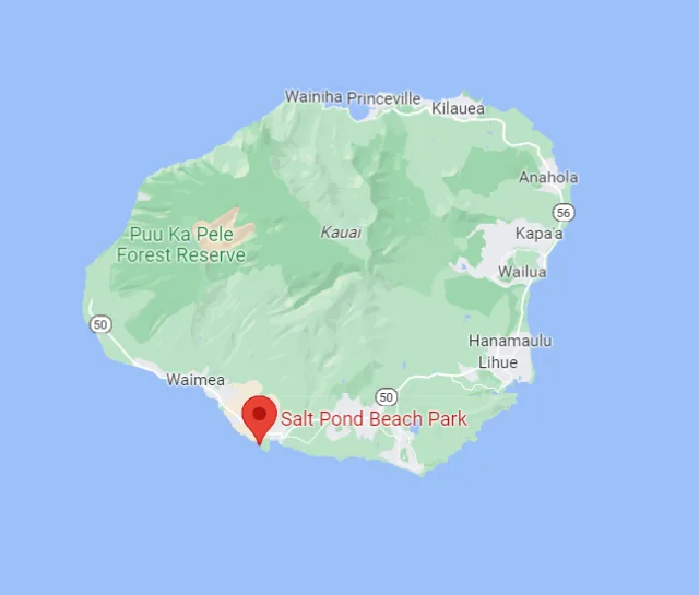
Salt Pond Beach Park is located on the sunny, arid southwest coast of Kauai, Hawaii, near the town of Hanapepe. Geographically, the park is situated on a low-lying, flat coastal plain. Its defining feature is a series of traditional, ancient Hawaiian salt evaporation ponds carved into the mudflats behind the beach, which give the area its name. These active salt beds, worked by local families under a traditional practice dating back centuries, create a unique mix of brackish and hypersaline water habitats adjacent to the ocean beach and reef system.
The surrounding environment consists of low, scrubby coastal vegetation, mudflats, and tidal pools, providing critical transitional zones between the land and the sea. The climate here is significantly drier than Kauai's northern and central regions, resulting in different plant communities and avian visitors.
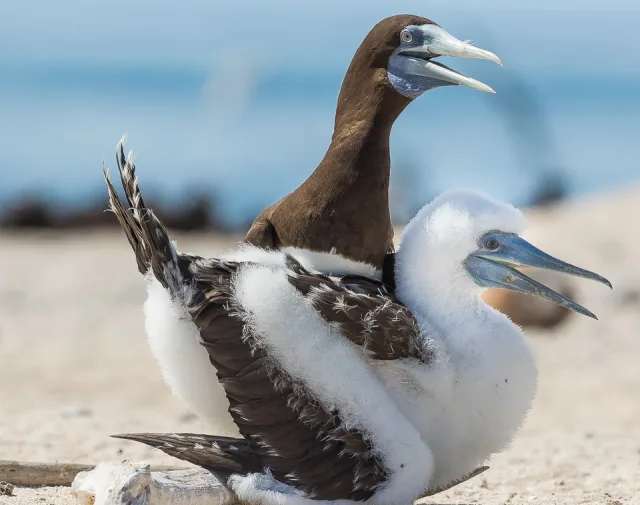
The unique blend of habitats makes Salt Pond a surprisingly rich location for birdwatching, offering opportunities to observe both resident seabirds and migratory shorebirds. The protected, calm waters offshore often attract species like the Brown Booby (Sula leucogaster) and various terns and gulls.
However, the primary birding interest lies in the adjacent salt ponds and mudflats. These areas serve as crucial resting and feeding grounds for several endangered Hawaiian waterbirds, including the elegant Aeʻo (Hawaiian Stilt, Himantopus mexicanus knudseni) and the 'Alae ke'oke'o (Hawaiian Coot, Fulica alai). During the non-breeding season, these mudflats also host numerous migratory shorebirds passing through the Pacific Flyway, such as various species of sandpipers and plovers, making it a valuable site for spotting less common transient species alongside the endemic Hawaiian natives.
Target Birds
Black-necked Stilt
Red-crested Cardinal
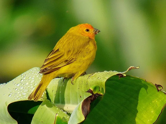
Saffron Finch
Bulwer's Petrel
Black Francolin
Wandering Tattler
The Outdoor Project has lots of details about facilities at the park and what visitors might find there.
Kaloko-Honokōhau National Historical Park
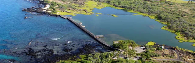
Kaloko-Honokōhau National Historical Park is situated on the dry Kona coast of the Island of Hawaiʻi (the Big Island). Geographically, the park spans a fascinating transition zone, encompassing both stark, relatively recent lava flows and lush, ancient coastal wetlands. The park protects approximately 1,160 acres of land and shoreline, characterized by a low, rocky coastline, sandy beaches, and numerous archaeological sites.
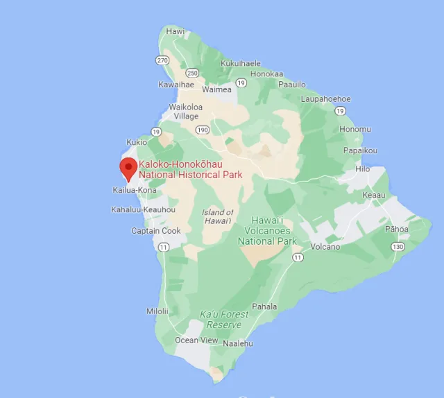
Its geography is crucial for its ecology, as the coastal plain contains several unique brackish water ponds and loko iʻa (fishponds), which are fed by cold, fresh groundwater springs that filter down from the high volcanic slopes and meet the ocean's salt water. This constant influx of fresh water creates productive estuaries that support a rich ecosystem, contrasting sharply with the arid ʻaʻa and pāhoehoe lava fields surrounding the area.
The park's unique blend of fresh and brackish water habitats makes it an important haven for birdlife, particularly for native Hawaiian waterbirds. The protected fishponds and marshy areas provide critical nesting and foraging grounds, offering some of the best birdwatching on the dry side of the island. Key target species include four of the endangered Hawaiian ākeʻake (coastal wading birds): the Hawaiian Stilt (Aeʻo), the Hawaiian Coot (ʻAlae keʻokeʻo), the Hawaiian Moorhen (ʻAlae ʻula) (though sightings here are rare), and the Hawaiian Duck (Koloa maoli).
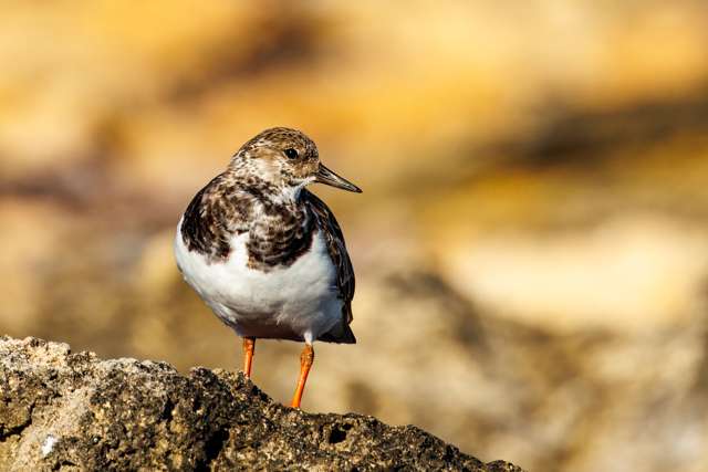
These birds rely heavily on the park's sheltered, shallow waters. Additionally, the park is an excellent place to observe various migratory shorebirds (like Sanderlings and Ruddy Turnstones) during the winter months, and common seabirds, such as the Wedge-tailed Shearwater, often nest in burrows along the coastal lava fields, offering diverse birding experiences concentrated along easily accessible trails.
Target Birds
Red Junglefowl
Hawaiian Coot
Gray Francolin
Ruddy Turnstone
Common Waxbill
Yellow-billed Cardinal
The National Park Service webpage for the area has basic visitor information and links to more details about culture, history and nature.
Kawai'ele State Waterbird Sanctuary
Kawaiʻele State Waterbird Sanctuary is a crucial conservation area located on the southwestern coastal plain of the island of Kauaʻi, Hawaii, near the town of Waimea. Situated at a low elevation, the sanctuary primarily consists of man-made shallow water impoundments (ponds), irrigation ditches, and open marshlands carved out of what was once agricultural land, particularly sugarcane fields.
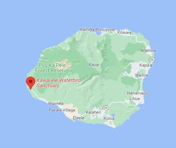
The area's geography is defined by its proximity to the ocean and the adjacent floodplains, creating a unique mix of freshwater, brackish, and sometimes hyper-saline conditions, depending on rainfall and tidal influence. The surrounding landscape includes dry coastal scrub and residential areas, making the marsh a vital green oasis for wildlife. The geography is flat, which is necessary for maintaining the mudflats and shallow water depths preferred by the waterbirds.
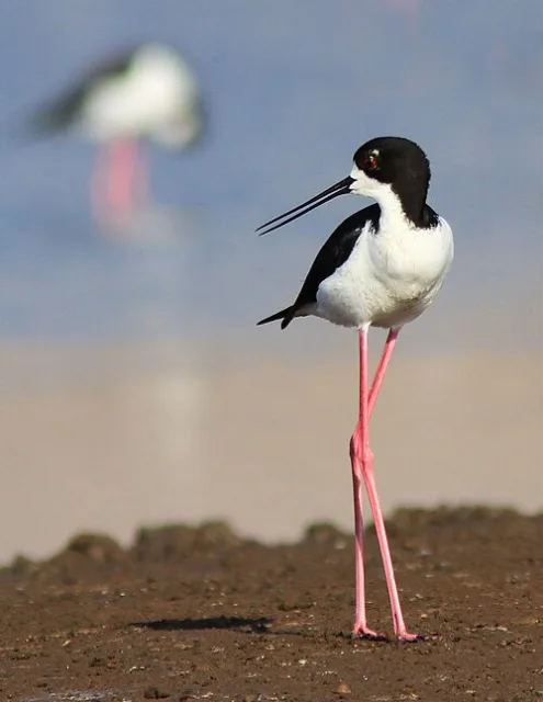
Kawaiʻele is a prime birdwatching location due to its reliably wet habitat and easy accessibility. The sanctuary's shallow ponds and extensive mudflats provide ideal foraging and nesting grounds for four of Hawaii's endangered endemic waterbirds. Key sightings include the Hawaiian Stilt (A'e'o), easily spotted with its long pink legs, and the Hawaiian Coot (ʻAlae keʻokeʻo).
Birders can also find the endangered Hawaiian Duck (Koloa maoli) and the highly elusive Hawaiian Moorhen (ʻAlae ʻula). While the area is focused on these native species, you'll also encounter numerous migratory shorebirds and ducks that stop over during the winter, offering excellent opportunities for photography and quiet observation from the roadside or designated viewing areas.
Target Birds
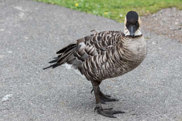
Hawaiian Goose
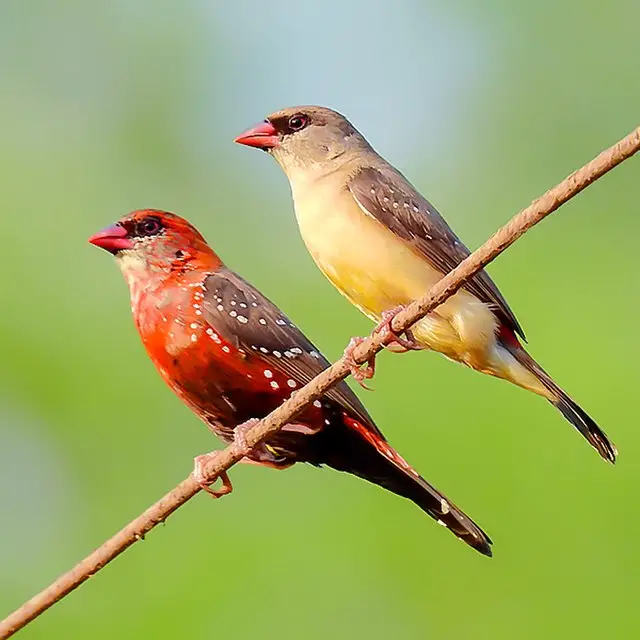
Red Avadavat
Barn Owl
Wedge-tailed Shearwater
Black-crowned Night Heron
The Hawaiian Islands website has a great review of the sanctuary with information about the birds you can find there.
Kanaha Pond Wildlife Sanctuary
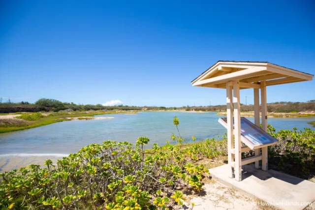
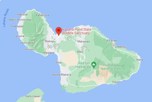
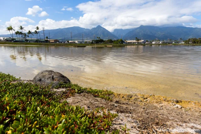
The Kanahā Pond Wildlife Sanctuary is a critical conservation area located on the island of Maui, Hawaii, immediately adjacent to Kahului Airport. Geographically, this 143-acre protected site consists primarily of hypersaline coastal wetlands, including two main ponds—Kanahā and Kōʻieʻie—separated from the ocean by dunes and human-made berms.
It sits within a geological depression formed by coral deposits overlying volcanic bedrock. This unique lowland location, combined with seasonal rainfall and fluctuating salinity levels, creates a specialized wetland habitat that is rare in the Hawaiian Islands. Its accessibility, being just minutes from the airport and Kahului town, makes it one of the easiest and most important places on Maui for birdwatching, particularly for viewing endangered Hawaiian waterbirds.
Kanahā Pond is an absolutely essential spot for birdwatchers because it provides vital breeding and feeding habitat for four of Hawaii's federally endangered endemic waterbirds. This includes the Hawaiian Stilt (Aeʻo), the Hawaiian Coot (ʻAlae keʻokeʻo), the Hawaiian Gallinule (ʻAlae ʻula), and the Hawaiian Duck (Koloa maoli). Visitors can observe these species foraging in the shallow mudflats and nesting in the dense, emergent marsh vegetation.
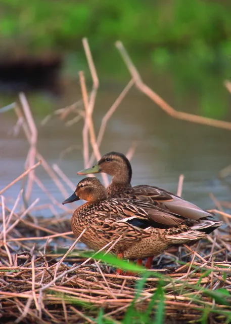
Beyond the endemics, the sanctuary also attracts numerous migratory shorebirds and ducks from North America and Asia during the winter months, offering excellent opportunities to spot species like the Pacific Golden-Plover and various species of migratory ducks. There is an observation deck and designated viewing areas, providing excellent, close-up, and disturbance-free viewing of these crucial conservation species.
Target Birds
Hawaiian Goose
Hawaiian Stilt
Pacific Golden Plover
Northern Pintail
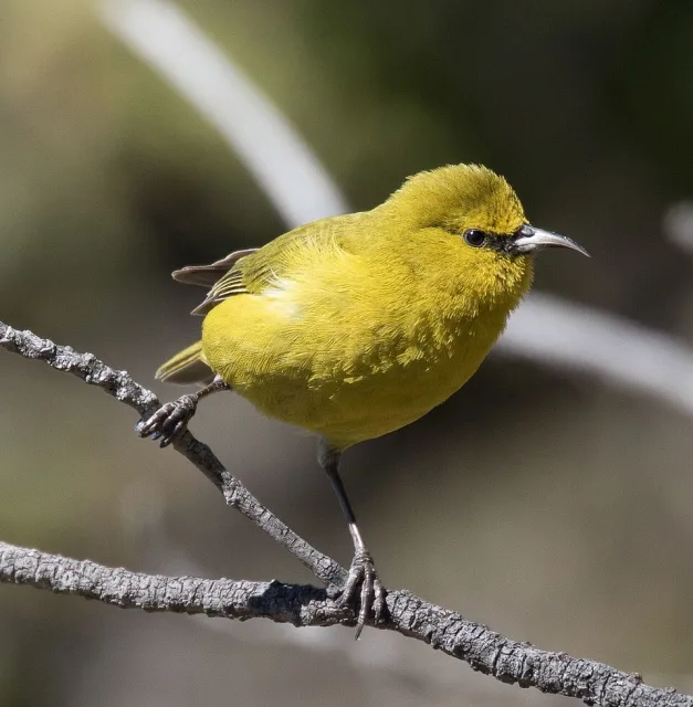
Hawaii Amakihi
White-rumped Shama
The Hawaii Government website for Forestry and Wildlife has a description of the area as well as the history and wildlife significance.
Haleakala National Park
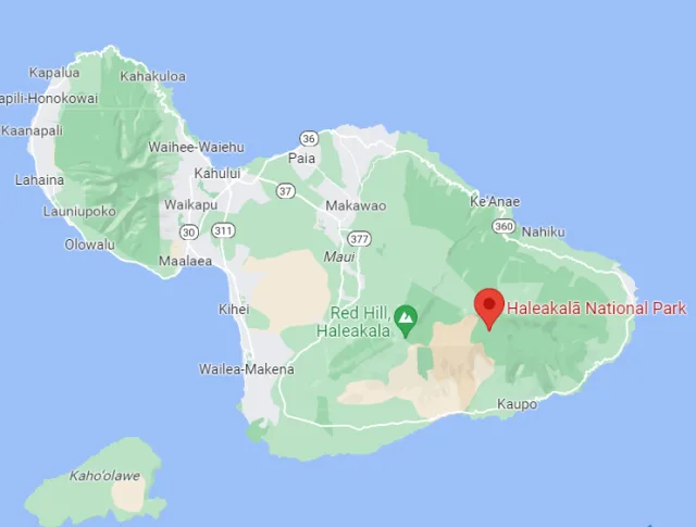
The varied geography of Haleakalā provides unique and critical birdwatching opportunities, particularly for viewing endemic Hawaiian honeycreepers—species found nowhere else. The Summit District's high-elevation shrublands are the last remaining refuge for some of Maui's rarest forest birds, accessible primarily via the Hosmer Grove campground and surrounding trails at the mid-elevation zone (around 6,800 feet). Here, birders have the best chance to spot the vibrant green 'Apapane and the yellow-green 'Amakihi, two of the more common honeycreepers.

Further into the high-elevation forests, specialized hiking may yield sightings of the highly endangered Maui Parrotbill or the 'Akohekohe (Crested Honeycreeper). The remote, wet rainforests of the Kīpahulu District, while less accessible and primarily devoted to sea-level viewing of seabirds and migratory shorebirds, contrast sharply with the montane environment and host different insect populations essential to bird life.

Target Birds
Maui Alauahio
l'iwi
Apapane
Hawaii Amakihi
Red-billed Leiothrix
Hawaiian Petrel
Maui Parrotbill
The National Park Service recommends that you plan any visit to the area carefully as it is a real wilderness.
Koke'e State Park
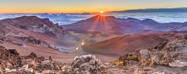
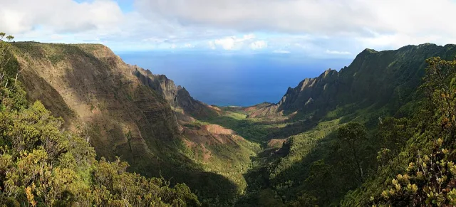
Kōkeʻe State Park, located on the island of Kauaʻi, Hawaiʻi, offers an unparalleled birdwatching experience far removed from the islands' coastal beaches. Situated on a high plateau on the western side of the island, the park encompasses roughly 4,345 acres and sits at elevations ranging from 3,200 to 4,200 feet.
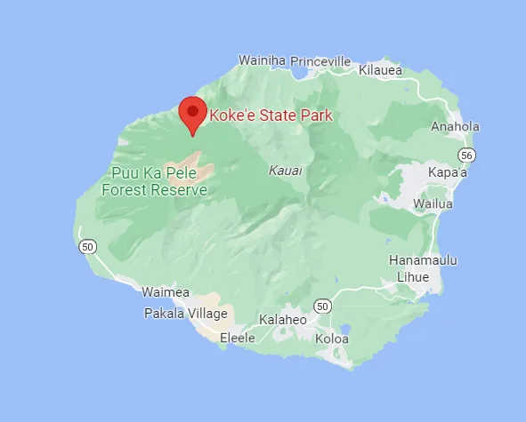
Its unique geography is defined by a landscape of native forest, deep valleys, and sheer cliffs, bordered to the east by the dramatic Waimea Canyon, often called "The Grand Canyon of the Pacific," and to the west by the remote, rugged Nā Pali Coast. The park's cool, often misty climate, high rainfall, and dense stands of ʻōhiʻa lehua and koa trees provide the perfect conditions for the native avifauna, which thrive in this protected montane environment.
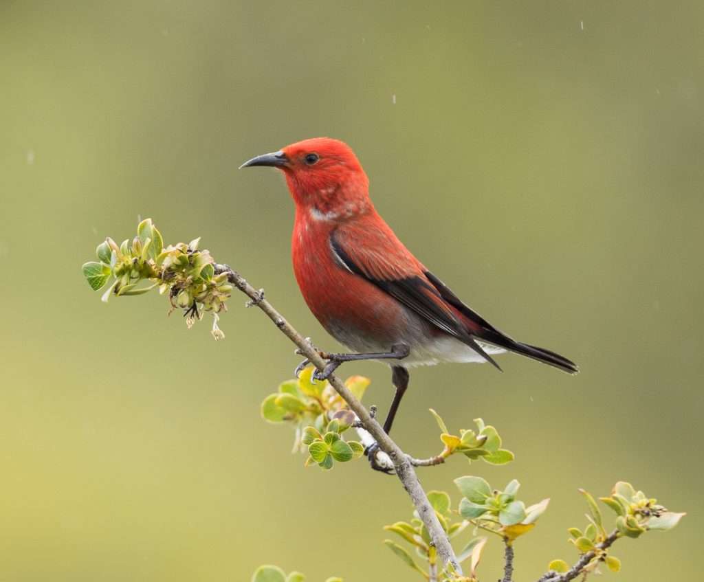
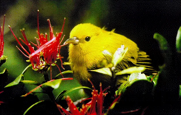
The ecological isolation and diverse habitats of Kōkeʻe make it a crucial refuge for Hawaiʻi's most cherished endemic forest birds. Birdwatching opportunities here are excellent, particularly along the numerous hiking trails like the Pihea Trail and in the designated native forest areas. This is one of the most accessible places to see endangered and rare species that have been decimated elsewhere in the islands. Key sightings often include the striking ʻApapane (Himatione sanguinea), the curious Kauaʻi ʻElepaio (Chasiempis sclateri), and the bright yellow ʻAmakihi (Chlorodrepanis stejnegeri).
While the tragic extinction of several Kauaʻi honeycreepers, such as the Kauaʻi ʻōʻō, looms over the region, Kōkeʻe remains a vital conservation area where dedicated birders have a real chance to connect with the unique, irreplaceable Hawaiian honeycreepers that define the islands' extraordinary avian heritage.
Target Birds
Kauaʻi ʻelepaio
Hawaiian Petrel
Newell's Shearwater
African Silverbill
Kauai Amakihi
Anianiau
Greater Necklaced Laughingthrush
The Hawaiian Division of State Parks has up to date access information about the park and its background.
Makalawena Beach
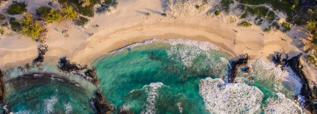
Makalawena Beach is a stunning, relatively secluded stretch of coastline located on the Kona coast of the Big Island of Hawaii. Geographically, it sits within the expansive Kona lava flows just north of the town of Kailua-Kona. The beach itself is characterized by striking contrasts: brilliant white coral-sand coves and dunes backdropped by rugged, dark black ʻaʻā and pāhoehoe lava fields.
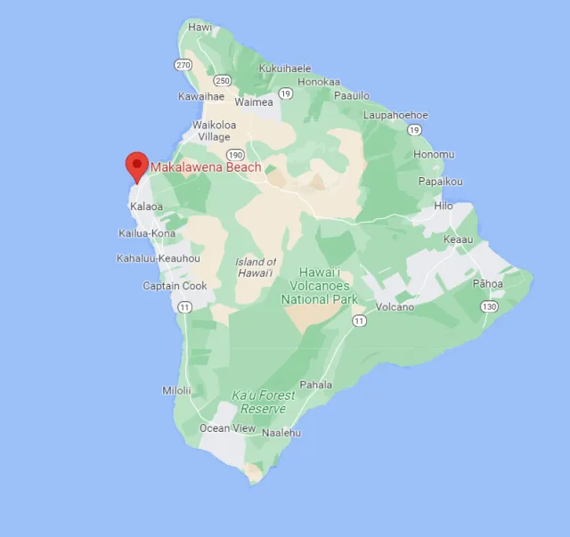
Access to the beach is challenging, typically requiring a 4x4 vehicle and a short, rugged walk across the lava fields from a nearby entry point, or a long walk along the coast from Kekaha Kai State Park, which helps maintain its undeveloped and pristine nature. The geography also includes three brackish ponds (loko) immediately behind the main dunes—Ōpae'ula, Pāhalā, and Leleiwi—which are crucial ecological features that support unique birdlife.
These three brackish ponds, along with the undisturbed coastal scrub and isolated nature of the area, provide excellent birdwatching opportunities, particularly for Hawaii's precious native and migratory wetland species. The ponds are one of the few places on the island that consistently hosts several species of Hawaiian wetland birds. Key sightings include the endemic and endangered Hawaiian Stilt (aeʻo) and the Hawaiian Coot (ʻalae kea), which utilize the ponds for nesting and foraging.
The surrounding dunes and scrub host the native 'Anianiau (an endemic honeycreeper, though less common at sea level) and migratory shorebirds like the Wandering Tattler (ʻūlili) and the Sanderling (hunakai) during the winter months. Because the area is remote and relatively undeveloped, it offers a tranquil setting for observing these species in their natural coastal habitat.
Target Birds
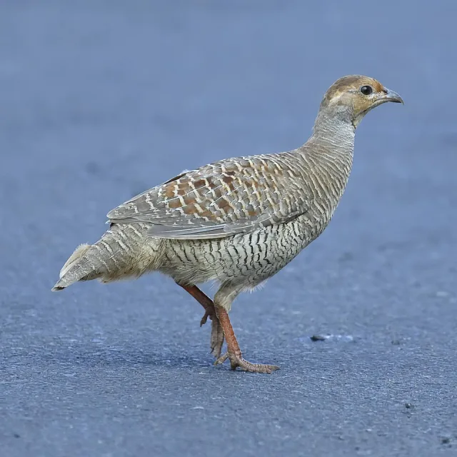
Gray Francolin
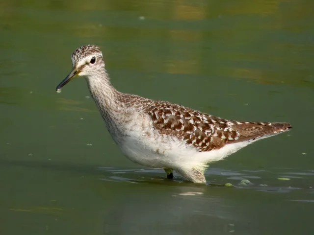
Wood Sandpiper
Saffron Finch
Brown Booby
Common Waxbill
Hawaiian Stilt
Access to the beach can be challenging. The bigislandguide has details about the area and the best way to visit.
James Campbell NWR
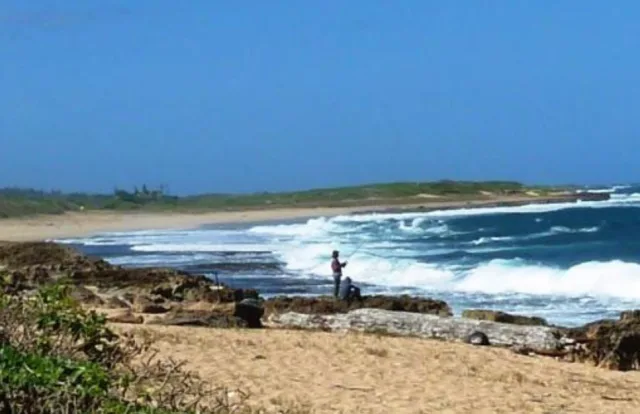
The James Campbell National Wildlife Refuge (NWR) is a crucial conservation area located on the North Shore of Oʻahu, Hawaii. Situated near the town of Kahuku, the refuge encompasses approximately 1,116 acres of diverse coastal wetland and agricultural lands. The geography of the refuge is dominated by low-lying, flat plains originally formed by coastal sediments and historically used for sugarcane production.
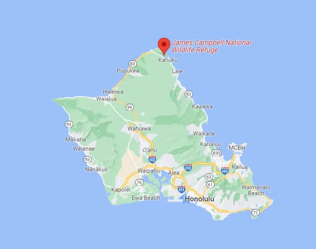
These lands include artificial and seasonal freshwater marshes, mudflats, and open water areas, which are maintained through careful water management practices. This man-made wetland habitat is critically important because Oʻahu has lost over 90% of its native wetlands to development and agriculture. The location, close to the ocean yet buffered by farmland, provides a safe haven for birds along the Pacific Flyway, making it a vital ecological stepping stone in the remote Hawaiian chain.
Birdwatching Opportunities and Access
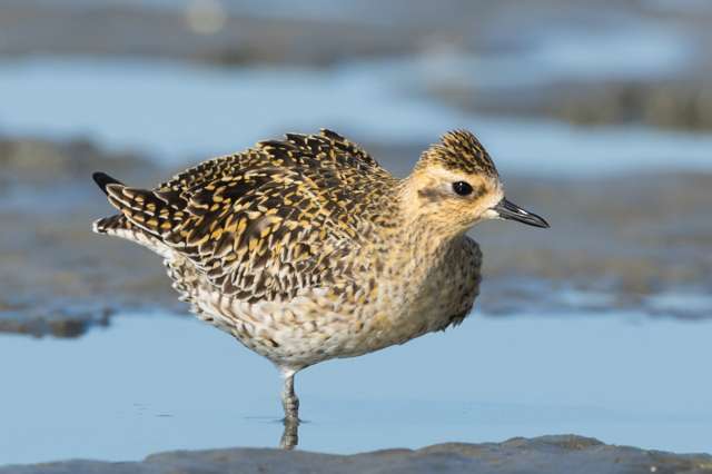
James Campbell NWR is a prime birdwatching destination, particularly for viewing Hawaiian endemic waterbirds and migratory shorebirds. The refuge provides crucial nesting habitat for four endangered Hawaiian species: the Hawaiian Stilt (A‘eo), Hawaiian Coot (ʻAlae keʻokeʻo), Hawaiian Gallinule (ʻAlae ʻula), and Hawaiian Duck (Koloa maoli). Visitors can also observe numerous migratory species, including Pacific Golden-Plovers (Kōlea), various sandpipers, and ducks that travel thousands of miles to winter here.
Due to its status as a critical refuge for endangered and sensitive species, access is highly restricted. The refuge is not open to the public year-round; access is generally limited to guided tours offered during the non-breeding season (typically October through mid-February). These tours are essential for safe, responsible viewing and ensure minimal disturbance to the protected bird populations.
Target Birds
Bristle-thighed Curlew
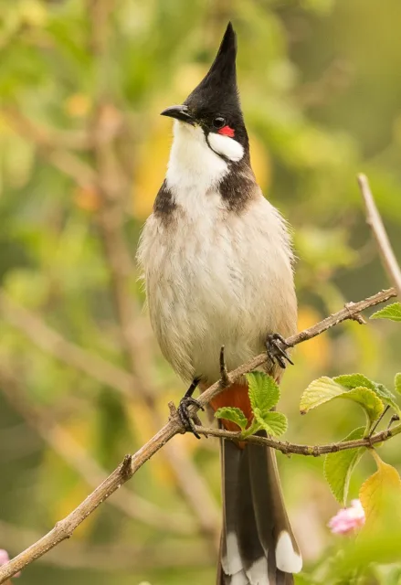
Red-vented and Red-whiskered Bulbul
Great Frigatebird
Cackling Goose
Northern Harrier
Laysan Albatross
The USFWS is an important reference when visiting the area as some parts have restricted access.
Kealia Pond NWR
Keālia Pond National Wildlife Refuge (NWR) is a crucial wetland habitat located on the island of Maui, Hawaii, situated along the southern coast of the island's central valley, just north of the town of Kīhei. Geographically, the refuge is dominated by its namesake, Keālia Pond, which is one of the few remaining natural wetlands in the state and one of the largest coastal marsh ecosystems in the Hawaiian Islands.
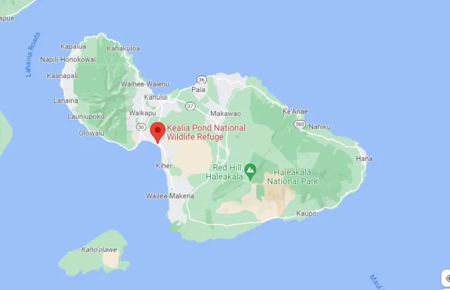
The pond itself is a dynamic, seasonally-flooded saline wetland covering approximately 700 acres. Its water levels fluctuate dramatically with rainfall and tidal influence, creating a mix of mudflats, shallow open water, and marsh vegetation (primarily pickleweed and various grasses). This unique coastal geography, nestled between the slopes of Haleakalā and the West Maui Mountains, provides a critical resting and feeding stopover point for migratory birds, as well as essential breeding habitat for several endangered native Hawaiian waterbirds.
Birdwatching at Keālia Pond NWR centers on observing both endangered endemics and widespread migratory species. The refuge is one of the best spots in Hawaii to reliably find the four native Hawaiian coots, stilts, and ducks. Key targets include the endangered Hawaiian Stilt (Aeʻo) and the endangered Hawaiian Coot (ʻAlae keʻokeʻo), which breed successfully in the protected shallow waters. Migratory shorebirds, particularly during the fall and spring, utilize the extensive mudflats, with sightings of species like the Pacific Golden-Plover (Kōlea), various sandpipers, and occasional rare vagrants thrilling birders.
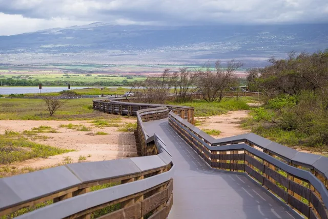
The refuge maintains a visitor center, a 2,200-foot boardwalk, and several viewing platforms that offer excellent, accessible vantage points for observation without disturbing the fragile habitat. It's a vital location for both conservation research and public appreciation of Hawaii's unique and threatened avian fauna.

Target Birds
Black Francolin
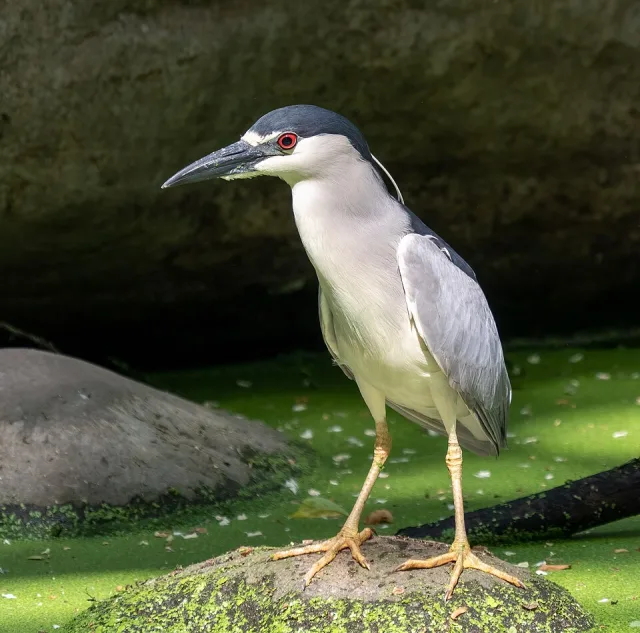
Black-crowned Night Heron
Maui Alauahio
Hawai'i Amakihi
Apapane
Osprey
The USFWS website has up to date information for visitors and is the best place to start when planning your bird watching here.
Wrapping Up
Birdwatching in Hawaii is a unique experience—one that offers profound beauty while demanding acute awareness of conservation realities. The archipelago's rich avian fauna, built upon the spectacular adaptive radiation of groups like the Hawaiian honeycreepers, represents an unparalleled treasure in evolutionary biology. However, the majority of these native forest birds are teetering on the brink of extinction, threatened by introduced species (such as rats and feral pigs), avian malaria spread by non-native mosquitoes, and habitat loss.
To see an endangered ʻiʻiwi or ʻapapane in the cloud forests of Maui or the Big Island is to witness a living piece of history and a testament to nature's brilliance. The opportunities for birding here are exceptional, but they are also a privilege. Every sighting serves as a crucial reminder: the future of Hawaii's endemic wonders rests heavily on effective conservation management, habitat preservation, and climate change mitigation. By visiting the high-elevation reserves and supporting conservation groups, birders become not just observers, but vital guardians of these irreplaceable island jewels.
