
California, with its staggering geographical diversity, is arguably the most dynamic birdwatching destination in North America. Its nearly 840-mile coastline, soaring mountain ranges, vast deserts, and rich interior valleys create an unparalleled variety of habitats, making it a funnel and permanent home for hundreds of species. The state is a primary route on the Pacific Flyway, attracting millions of migrating birds annually.

This article explores the contrasting, yet equally magnificent, birding opportunities found across the Golden State. We'll travel to the dramatic southern tip of Monterey Bay to explore the renowned pelagic bird migration spectacle at Point Pinos, and head far north to discover the innovative urban wetlands of the Arcata Marsh and Wildlife Sanctuary, demonstrating why California is an essential pilgrimage for every serious birder.
Andrew Molera State Park
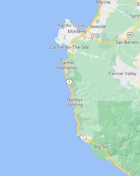
Andrew Molera State Park is the largest state park along California's rugged Big Sur coastline, encompassing nearly 5,000 acres in Monterey County, approximately 20 miles south of Carmel. Its geography is characterized by a spectacular meeting of diverse ecosystems: the Big Sur River, the park's namesake, flows through riparian woodlands and grassy meadows before emptying into the Pacific Ocean at Molera Beach.
The coastal terrace gives way to dramatic headlands, coastal scrub, and high ridges that ascend into the Santa Lucia Mountains, offering miles of trails through redwoods, sycamores, and chaparral. This relatively undeveloped park provides a critical slice of pristine Central Coast habitat, making it a hotspot for both resident and migratory species moving along the Pacific Flyway.
The varied landscape makes Andrew Molera an exceptionally rewarding location for birdwatchers. The presence of the Ventana Wildlife Society's Discovery Center underscores the park's importance, particularly its role in the successful reintroduction of the California Condor; visitors often have the thrilling opportunity to spot these critically endangered birds soaring overhead along the ridges and bluffs.

The river mouth and estuary are magnets for waterfowl and shorebirds, including Common Mergansers and various gulls, while the extensive trails lead through habitats perfect for seeking out woodland and scrub species like Steller's Jays, California Quail, and various species of warblers and towhees. During the winter, the park also hosts impressive concentrations of Monarch Butterflies, often found clustering in the eucalyptus groves near the historic Cooper Cabin, adding another layer to its incredible seasonal wildlife spectacle.

Target Birds
Acorn and Nuttall's Woodpecker
Western, Short-billed, Glaucous and California Gull
- Hutton's and Warbling Vireo
Pacific and Bewick's Wren
Pacific and Common Loon
Orange-crowned and Wilson's Warbler
California Condor
California Department of Parks and Recreation has information for visitors.
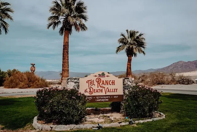
The Ranch at Death Valley
The Ranch at Death Valley, located in the Furnace Creek area of Death Valley National Park, offers a truly unique geographical paradox: a lush, managed oasis set amidst the stark, extreme environment of the Mojave Desert. The Ranch is situated at an elevation of approximately 200 feet below sea level, a short distance from Badwater Basin, the lowest point in North America.

This area is sustained by underground natural springs, which feed the resort's extensive grounds, including towering date palm groves, large sprawling lawns, and the adjacent Furnace Creek Golf Course. This geography of concentrated water and vegetation contrasts sharply with the surrounding mountains and arid salt flats, making it an indispensable refuge for wildlife, especially birds, crossing the vast, unforgiving desert.
For birdwatchers, The Ranch serves as a crucial magnet and a "vagrant trap," attracting both resident desert species and countless migratory birds in transit along the edge of the Pacific Flyway. The most notable birding feature is the viewing platform next to Airport Road, which overlooks one of the area's ponds, often hosting wintering and migratory waterfowl and shorebirds.
The cottonwood and palm groves around the property are excellent places to search for small migratory passerines, such as various species of warblers, vireos, and flycatchers, which stop here to rest and feed before continuing their journey. During the peak migration periods in spring and fall, the contrast between the lush, bird-filled oasis and the surrounding desolate desert makes The Ranch at Death Valley one of the most exciting and rewarding birding locations in the entire National Park system.

Target Birds
Wigeon
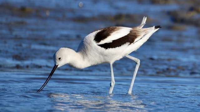
American Avocet
Lazuli Bunting
Hammond's and Gray Flycatcher
Warbling and Cassin's Vireo
Zone-tailed Hawk
Vermilion Flycatcher
Furnace Creek Campground is not only somewhere to stay but also has information about the area.
Point Pinos
Point Pinos is the dramatic, windswept northwestern tip of the Monterey Peninsula in Pacific Grove, Central California. Geographically, it is a low-lying, rocky headland that juts out prominently into the Pacific Ocean at the southern entrance to Monterey Bay. This geological position is key to its status as a world-renowned birding site: it is the outermost land point along a contour that concentrates migrating seabirds flying south along the coast, forcing them into a narrow, observable corridor.
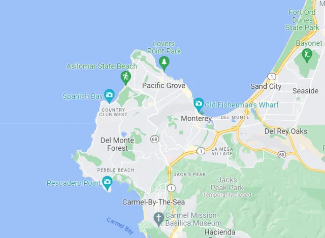
The Point Pinos Lighthouse, the oldest continuously operating lighthouse on the U.S. West Coast, provides an easily identifiable and historically significant landmark for birders. The immediate surroundings include a small, well-known freshwater marsh, Crespi Pond, and coastal scrub, offering contrasting habitats to the marine environment.
The location's geography makes it the premier spot for land-based seawatching on the entire West Coast. Birdwatching opportunities are superb year-round but reach a spectacular peak during the fall migration (typically November to mid-December), when the Monterey Audubon Society runs an annual, dedicated seawatch count. During these periods, birders can witness a thrilling, high-volume passage of pelagic species and waterfowl flying close to shore.
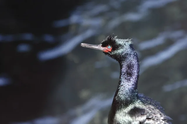
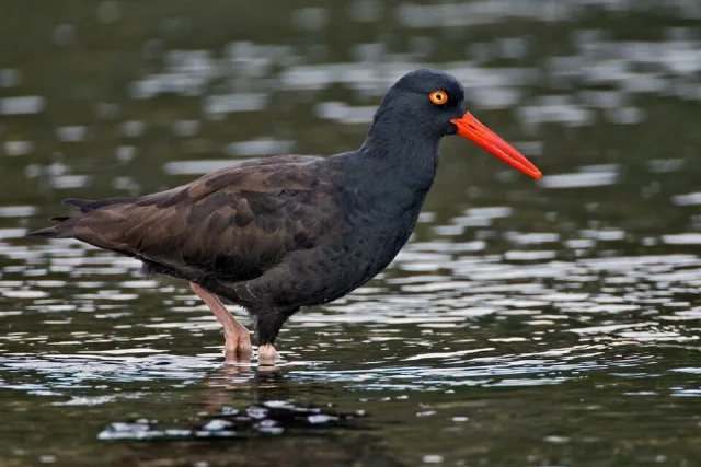
Common sightings include huge flocks of Surf Scoters and various loons (Pacific, Common, and Red-throated). The possibility of spotting true open-ocean rarities like shearwaters, jaegers, murres, and even occasional albatrosses or boobies (often after major storms) is what draws advanced birders, while the rocky intertidal zone near the point provides reliable views of foraging Black Oystercatchers and other shorebirds.

Target Birds
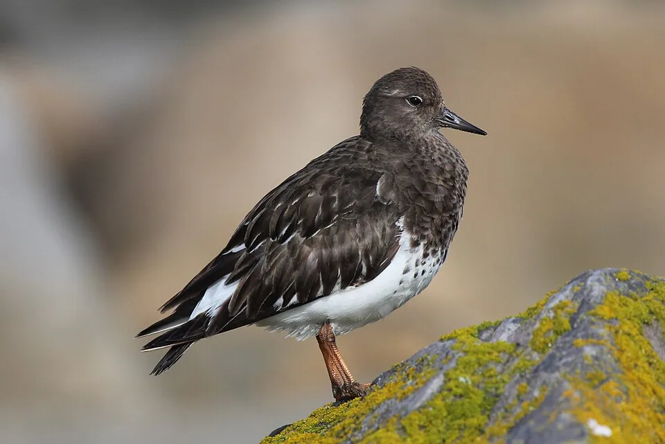
Black Turnstone
Hermann's, Glaucous-winged and Western Gull
Brandt's and Pelagic Cormorant
Vaux's Swift
Bewick's Wren
California Scrub-Jay
- The Monterey Audubon Society is a lovely website with information about the area and bird watching activities there.

Salton Sea State Park
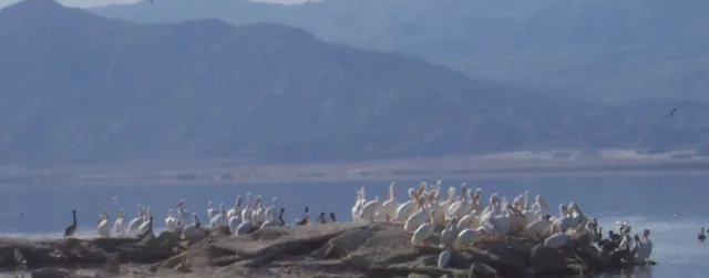
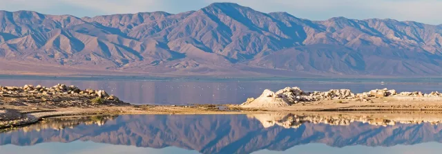
Salton Sea State Recreation Area (SRA) is located on the northeastern shore of the Salton Sea, California's largest lake, straddling the boundaries of Riverside and Imperial Counties. Its geography is dramatic: the massive, terminal lake lies within the deep Salton Trough, placing its surface more than 200 feet below sea level, surrounded by the harsh, arid landscapes of the Colorado Desert section of the Sonoran Desert.
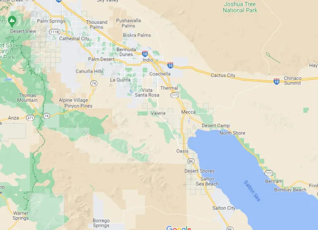
Although the lake was accidentally created in 1905-1907 by an engineering failure on the Colorado River, it swiftly became a hyper-saline, yet critically important, inland water body. The surrounding environment consists of mudflats, sand dunes, and patches of desert scrub, with the towering Santa Rosa Mountains providing a breathtaking backdrop across the immense, shallow sea.
Despite its environmental challenges, the Salton Sea and its State Park remain one of the most vital birdwatching destinations on the Pacific Flyway, with over 400 species recorded in the surrounding area—nearly half of all North American species. Birdwatching is best during the cooler months, from November through February, when up to four million individual birds are estimated to use the Sea daily during peak migration.
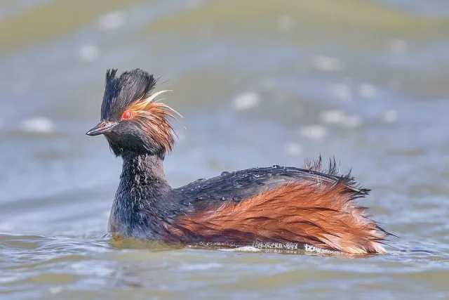
Visitors are drawn by the huge concentrations of waterfowl and shorebirds, including thousands of Eared Grebes and American White Pelicans. Unique viewing opportunities include spotting the regional specialty, the Yellow-footed Gull, during late summer and looking for endangered species like the Yuma Ridgway's Rail and the California Brown Pelican, which occasionally visit. The park offers trails and a visitor center (open seasonally) to help birders navigate this unique desert oasis.
Target Birds
Loggerhead Shrike
Blue Gray and Black-tailed Gnatcatcher
Abert's Towhee
Greater Roadrunner
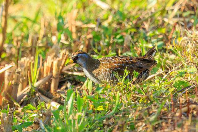
Ridgway's Rail and Sora
Burrowing Owl
California Department of Parks and Recreation has comprehensive visitor information.
Arcata Marsh and Wildlife Sanctuary
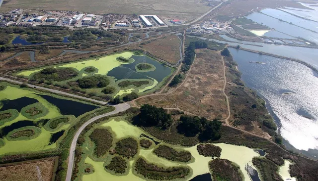
The Arcata Marsh and Wildlife Sanctuary is a globally renowned 307-acre marvel of ecological engineering, situated on the northern edge of Humboldt Bay in Northern California. Located directly on the Pacific Flyway, this sanctuary is unique because it functions as the final, natural step in the City of Arcata's innovative wastewater treatment process.
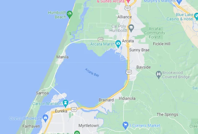
The geography is a complex mosaic of constructed freshwater marshes, brackish ponds, tidal sloughs, mudflats, and grassy uplands, all integrated into the city’s urban environment. This blend of habitats, from the open water of Klopp Lake to the dense cattails of the treatment marshes, was created by integrating conventional treatment with natural wetland processes, turning a former landfill and log pond area into a thriving and sustainable ecosystem.
This pioneering conservation model has made the Arcata Marsh one of the most accessible and bird-rich sites on the West Coast, hosting over 330 recorded species. The rich nutrient flow and varied habitats provide exceptional year-round birdwatching opportunities. During high tide, the mudflats of Humboldt Bay are covered, causing thousands of shorebirds—such as Marbled Godwits, Dunlin, and sandpipers—to fly into the safety of the marsh islands.
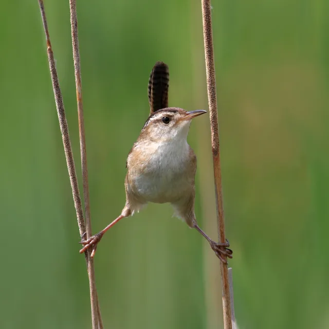
Winter brings in massive numbers of waterfowl, including various ducks and diving birds, while the marsh vegetation is home to secretive residents like Virginia Rail and Marsh Wren. The ease of access, with approximately five miles of flat, well-maintained trails and an Interpretive Center, ensures visitors can get close views of this abundant avian life, making it a spectacular example of how urban infrastructure can successfully coexist with, and even enhance, wildlife habitat.

Target Birds
Northern Harrier
Tree, Barn and Violet-green Swallow
Osprey and Bald Eagle
MacGillivray's Warbler
Black-headed Grosbeak
Ferruginous Hawk
City of Arcata - Arcata Marsh & Wildlife Sanctuary
IRWD San Joaquin Marsh & Wildlife Sanctuary
The IRWD San Joaquin Marsh & Wildlife Sanctuary is a remarkable 300-acre coastal freshwater wetland complex nestled directly within the highly urbanized landscape of Irvine, California, in Orange County. Its location, just inland from Upper Newport Bay and adjacent to UC Irvine, makes it a critical green space and an accessible birding hotspot for millions of residents.
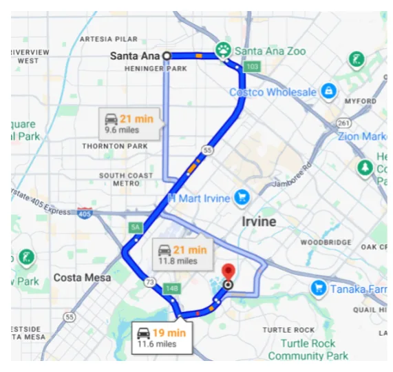
Geographically, the marsh lies in the floodplain of San Diego Creek, and its current form is a triumph of environmental engineering: it is a constructed wetland system developed and managed by the Irvine Ranch Water District (IRWD) to naturally treat urban runoff and remove pollutants, particularly nitrates, before the water flows into the environmentally sensitive bay. This functional geography—a series of ponds, channels, and marshlands surrounded by trails and native plantings—creates a beautiful and highly productive ecosystem.
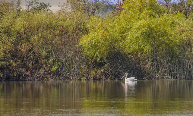
This sanctuary's carefully managed wetlands and diverse plant life provide exceptional birdwatching opportunities, boasting a list of over 200 bird species recorded on site. As a key stopover on the Pacific Flyway, the marsh attracts massive numbers of migrating waterfowl, including various species of ducks and geese.
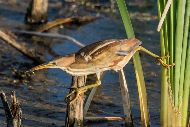
Birders can walk over 12 miles of trails and boardwalks to observe resident species such as Great Blue Herons, Great Egrets, and the occasional Osprey fishing in the ponds. The area is particularly excellent for observing marsh-dwelling birds like Rails and Bitterns, as well as nesting wading birds. The proximity of the Sea and Sage Audubon Society's center further enhances the experience, making the San Joaquin Marsh a premier example of how urban infrastructure and critical wildlife habitat can successfully coexist.
Target Birds
- Blue-winged and Cinnamon Teal
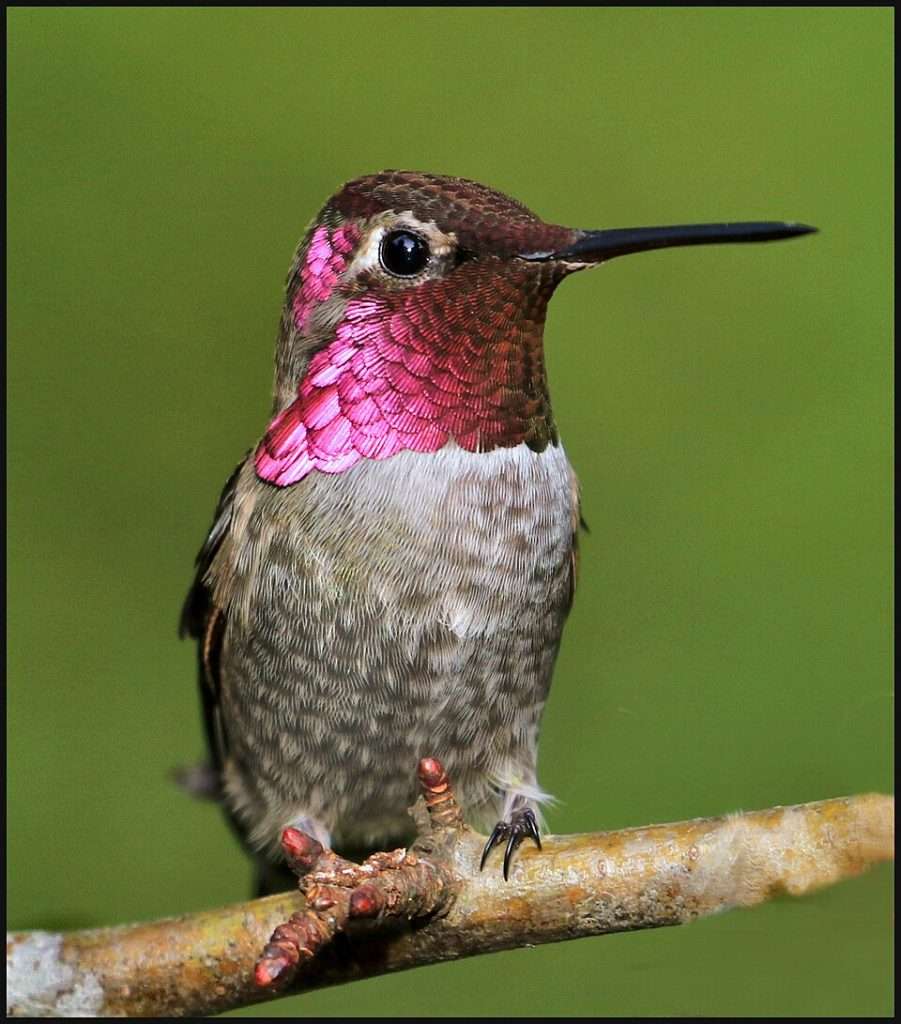
- Anna's Hummingbird
- Western, Clark's and Pied-billed Grebe
- Nuttall's Woodpecker
- California Towhee
The USFWS has good information and should be checked before visiting.
Big Morongo Canyon Preserve & Covington Park
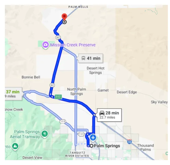
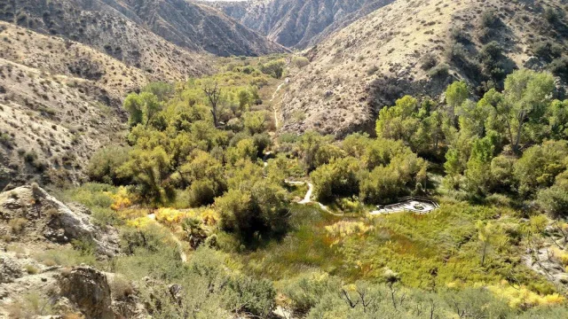
The Big Morongo Canyon Preserve, alongside the adjacent Covington Park, is a remarkably lush 31,000-acre oasis nestled in the Little San Bernardino Mountains, strategically situated at the ecological transition zone between the higher Mojave Desert and the lower Colorado Desert (Sonoran Desert). Located off State Route 62 in Morongo Valley, the preserve's unique geography is defined by a perennial flow of water—Big Morongo Creek—caused by a local fault line.
This consistent water source sustains one of the ten largest Cottonwood and Willow riparian habitats in all of California, contrasting dramatically with the surrounding arid scrub. This sheer abundance of water and dense vegetation creates a critical refuge for wildlife, earning it the designation of an Important Bird Area (IBA) by multiple conservation groups.
This rare desert wetland and riparian forest acts as an internationally recognized bird magnet, hosting over 250 recorded bird species, with at least 72 species known to breed here. The concentrated water and shade make it an essential stopover site during both spring and fall migration, providing excellent viewing opportunities for warblers, flycatchers, and tanagers that would otherwise be hard to find in the desert.
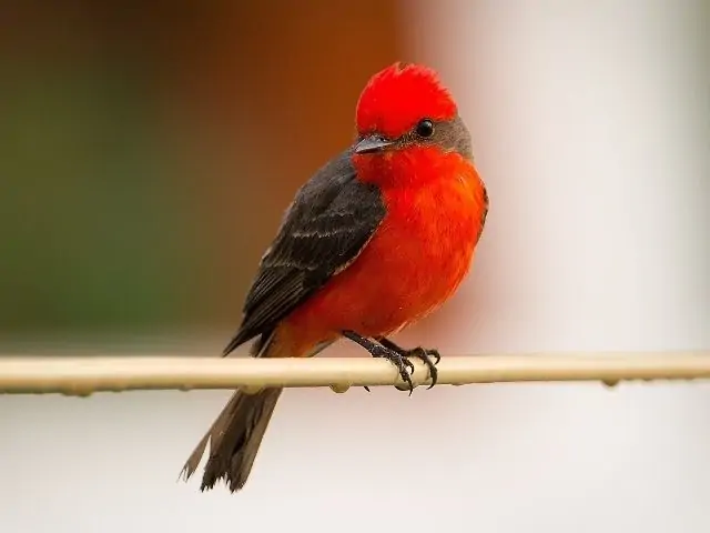
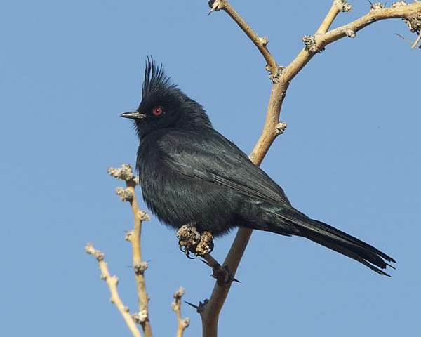
Year-round highlights include sought-after desert birds like the vibrant Vermilion Flycatcher, Ladder-backed Woodpecker, and Phainopepla. Birders can explore the area via eight miles of trails, including an easily accessible boardwalk that winds through the wet marshlands, making the Big Morongo Canyon Preserve and its neighboring Covington Park an indispensable destination for any birder visiting Southern California.
Target Birds
- Gambel's Quail
- Costa's Hummingbird
- Cassin's Kingbird
- Verdin
- Phainopepla
San Bernadino County has information about the area and regular bird walks.
Malibu Lagoon and Surrounds
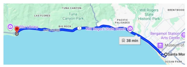
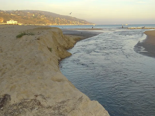
The Malibu Lagoon State Beach is a celebrated coastal estuary and tidal wetland system located in the heart of Malibu, California, where the Malibu Creek flows directly into the Pacific Ocean. Situated right off the iconic Pacific Coast Highway (PCH), its geography is characterized by a dynamic, shallow water basin, extensive intertidal mudflats, and a coastal salt marsh habitat.
This vital wetland, which has undergone significant restoration efforts, is one of the few remaining functional coastal lagoons in the highly urbanized Southern California region. Its proximity to the Santa Monica Mountains National Recreation Area means it serves as a critical biological corridor where terrestrial, riparian, and marine ecosystems converge, making it a unique ecological nexus in Los Angeles County.
Malibu Lagoon's rich variety of habitats, including the sandy beach, exposed mudflats, and dense marsh vegetation, make it an exceptional birdwatching hotspot, with over 200 species recorded. The lagoon is particularly indispensable for shorebirds and waterfowl, especially during winter and migration periods. Birders frequently spot large concentrations of Brown Pelicans, several species of gulls, and wading birds like the Great Egret and Great Blue Heron.
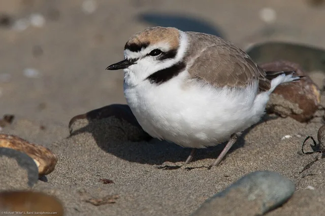
The sensitive beach areas often host the federally threatened Western Snowy Plover, and the marsh vegetation provides shelter for secretive species like the Virginia Rail. The adjacent Surfrider Beach and the Malibu Pier offer additional opportunities to observe pelagic (open ocean) species, making the entire area a single, high-value stop for anyone looking to document the diversity of California's coastal avifauna.
Target Birds
- Black Oystercatcher
- Bonaparte's Gull
- Royal Tern
- Black-necked Grebe
- Least Sandpiper
- Gray Plover
The San Fernando Audubon Website has some information about the area.
Southeast Farallon Island
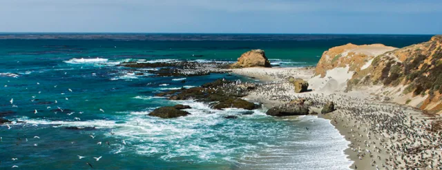
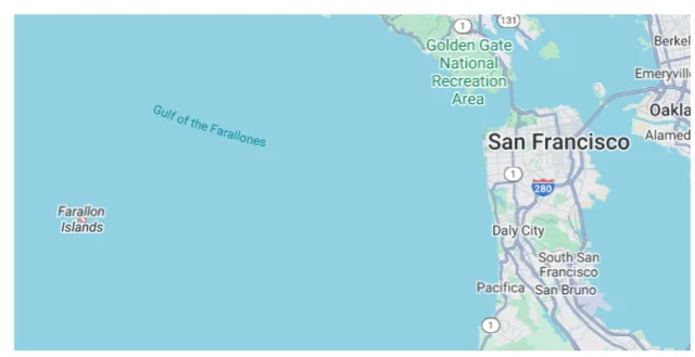
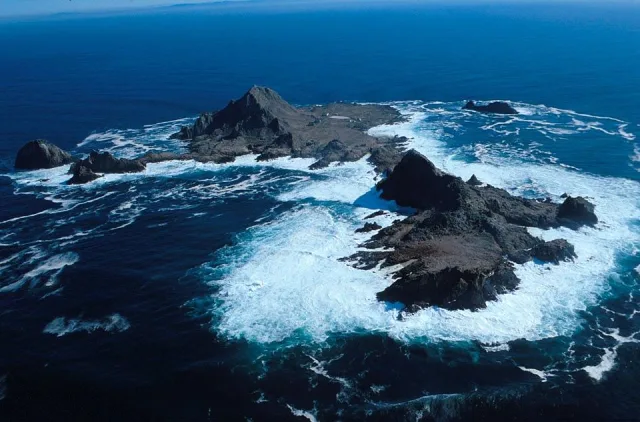
Southeast Farallon Island (SEFI) is the largest and only inhabited island of the Farallon Islands archipelago, a rugged and biologically crucial group of sea stacks located approximately 27 miles west of San Francisco's Golden Gate Bridge in the Pacific Ocean. Its geography is characterized by granite bedrock, steep cliffs, and craggy outcroppings rising up to 358 feet above the sea, offering little in the way of soil or dense vegetation.
This remote, exposed environment sits amid a cold, nutrient-rich upwelling zone within the California Current. This highly productive ocean environment creates a massive, year-round food supply, establishing the Farallones as a globally significant marine sanctuary protected as part of the Farallon Islands National Wildlife Refuge and the Greater Farallones National Marine Sanctuary.
SEFI is widely celebrated as the site of the largest seabird nesting colony in the contiguous United States, hosting roughly 180,000 birds from 13 different breeding species. While landing on the island is strictly prohibited (only researchers and scientists live there), birdwatching from commercial boat tours provides an unforgettable spectacle.
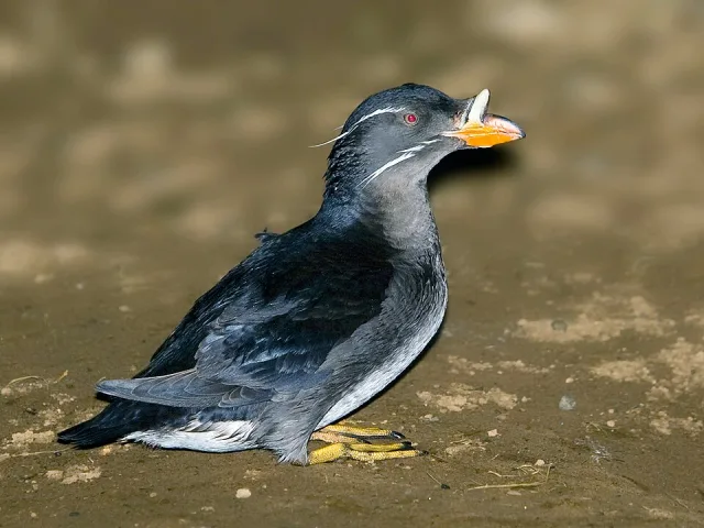
Key breeding species to look for include vast, dense colonies of Common Murres, as well as Pigeon Guillemots, Brandt's Cormorants, and the endearing Tufted and Rhinoceros Auklets. Furthermore, the islands are renowned for tracking landbird migration: their location far offshore makes them a vital, final stopover for exhausted songbirds, leading to a huge number of rare sightings, or "vagrants," making the total species list for the island well over 400. Visitors can also expect to see marine mammals like sea lions and, seasonally, various species of whales and the infamous Great White Sharks.
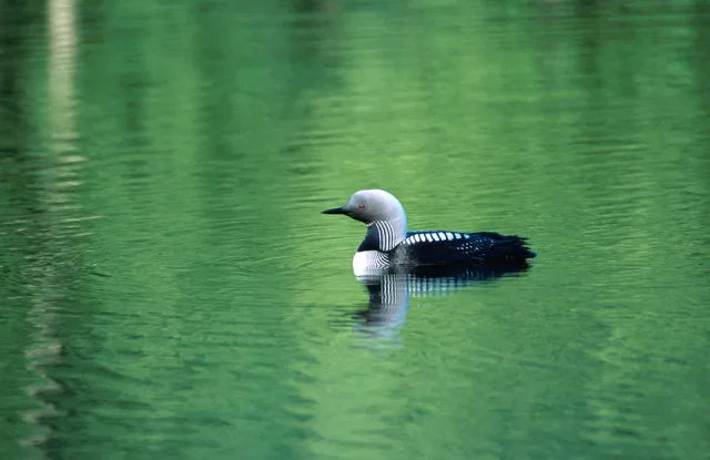
Target Birds
- Gray Phalarope
- Black Turnstone
- Cassin's Auklet
- Pacific Diver
- Northern Fulmar
- Ashy Storm-Petrel
The Farallon Islands National Wildlife Refuge website can be accessed here.
Wrapping Up
California truly lives up to its reputation as a birding mecca, offering a spectrum of avian experiences unmatched by any other state. From the immense seabird colonies and remarkable vagrant opportunities at places like Southeast Farallon Island to the prime shorebird and pelagic viewing along the Monterey coast at Point Pinos, and the innovative conservation successes of sites like the Arcata Marsh and Wildlife Sanctuary, the state provides critical habitat for hundreds of species. Its unique position on the Pacific Flyway, coupled with an incredible range of geographical features—from high Sierra peaks to arid deserts and vast coastal wetlands—ensures that every season brings new and thrilling possibilities. Whether you seek to add rare vagrants to your life list or simply wish to witness the spectacle of migration, California offers a lifetime of birding adventures and confirms its place as an essential destination for every serious bird enthusiast.
