
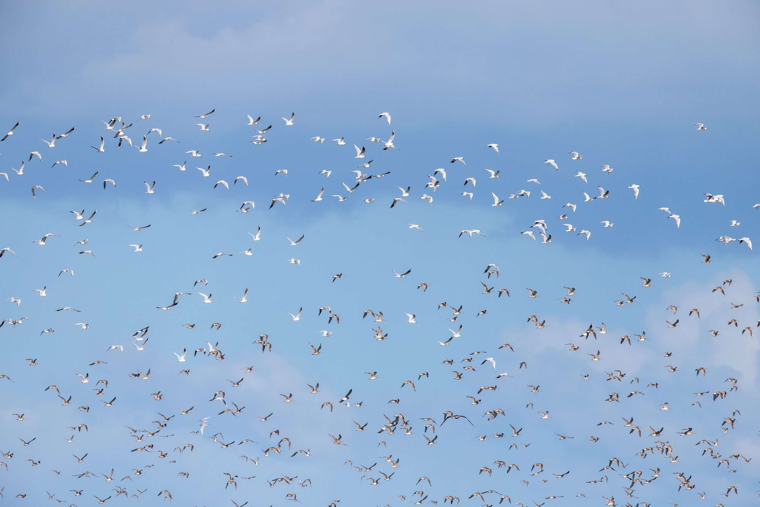
For centuries, bird migration was one of nature's great mysteries, a miraculous annual pilgrimage understood only through scattered sightings and the occasional banded bird recovery. Today, thanks to a confluence of sophisticated technology and the power of citizen science, we are witnessing the spectacle of migration in real-time. Birders and professional ornithologists across the U.S. are now using tools originally designed for weather forecasting and military communications—NEXRAD radar and satellite telemetry—combined with the massive data input of eBird to not just observe migrating birds, but to map and even predict their movements.
This technological revolution has transformed birding from a passive hobby into an active, data-driven science, providing unprecedented insights into avian ecology, behavior, and conservation needs.
The Real-Time View: Harnessing NEXRAD Weather Radar
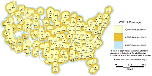
The most accessible and widely used high-tech tool for tracking migration en masse is the Next-Generation Radar (NEXRAD) network, operated by the National Weather Service (NWS). While designed to detect rain and severe storms, this network of 160 high-powered Doppler radars is remarkably effective at detecting airborne creatures.
How Radar Sees Birds
Birds, particularly when flying in large, dense groups, are detected by NEXRAD as biological targets. The radar beam bounces off the birds' bodies, which registers a faint, diffuse echo—often called "biological clutter" by meteorologists.
- The Roost Departure: The most dramatic and observable radar event occurs at dusk or shortly after sunset. As millions of birds leave their daytime roosts to begin nocturnal migration, they create massive, expanding blobs on the radar screen. These concentric rings of high reflectivity are known as "roost rings" or "take-off rings."
- The Flight Layer: Once airborne, migrating birds typically settle into a preferred flight altitude, often between 500 and 5,000 feet, to take advantage of favorable winds. This creates a large, uniform area of low-level reflectivity on the radar. Ornithologists can use sophisticated algorithms to estimate the density and direction of these migrating masses.
- Reading the Scan: Birders look for patterns of low reflectivity (usually appearing as a diffuse light blue or green color) over large geographic areas on clear, warm nights with light winds. A sudden "clearing" of these reflectivity patterns on radar near dawn indicates that the birds have landed—a major signal for birders to visit nearby parks and migration traps.
Practical Application
Radar allows birders to anticipate large "fallouts" (when weather conditions force a huge number of migrants to land) with remarkable accuracy. If radar shows a major flow of birds hitting a cold front or a major body of water (like the Great Lakes or the Gulf Coast) just before sunrise, birders know exactly where to position themselves for a spectacular morning of viewing.

The Micro View: Satellite Telemetry and Nano-Tags
While radar captures the mass movement, satellite technology provides the deeply detailed, individual migratory paths of rare or specific species.
The Power of Miniaturization
The key breakthrough has been the miniaturization of tracking devices. Modern GPS and satellite transmitters are now small enough—sometimes weighing less than a dime—to be safely attached to birds as small as thrushes and warblers.
- PTTs and Argos: Researchers attach these miniature Platform Transmitter Terminals (PTTs) to a bird's back (often harnessed like a tiny backpack). The PTTs relay data to orbiting satellites (such as the Argos system), which pinpoints the bird's location with high precision, sometimes multiple times a day.
- Motus: A more recent development is the Motus Wildlife Tracking System, a collaborative network of automated radio telemetry receiving stations. When a bird carrying a tiny, coded radio tag (a nano-tag) flies within range of a Motus tower, its position is logged. This provides high-resolution data on local movements, stopover duration, and fine-scale migration routes.
Real-World Impact
Satellite telemetry has completely rewritten our understanding of several species:
- It proved that endangered Kirtland's Warblers follow highly specific, narrow migration corridors.

- It showed that some Arctic Terns migrate farther than previously imagined, circling the globe.

Arctic Tern - It revealed the critical importance of specific, often unprotected, stopover sites along the Gulf Coast and the Great Lakes, highlighting specific areas for conservation focus.

The Citizen Science Layer: eBird's Global Data Pool
Neither radar nor satellites provide the final, essential piece of the migration puzzle: species-level identification. This information is supplied by the millions of user-submitted records compiled by eBird, a free online platform managed by the Cornell Lab of Ornithology.
Data Aggregation and Visualization
eBird harnesses the collective effort of the global birding community. Every time a birder submits a checklist—detailing the species, count, date, and location of their sightings—that data point is added to a massive database.
- Mapping the Front: eBird uses this aggregated data to create dynamic animated maps that visualize the spread and progression of migration. A birder can watch the "front" of the Ruby-throated Hummingbird migration move northward week by week, or see exactly where the first Ovenbirds arrived this season.

Ovenbird - Predicting Arrival: By analyzing years of submitted data, eBird can predict the median arrival date for hundreds of species in any given location. This allows birders to precisely time their visits to parks and hotspots for maximum viewing success.
- Vagrancy Alerts: The eBird system includes a rigorous review process for rare bird sightings. Once a rare bird is accepted by local reviewers, the data is shared globally, instantly alerting birders to a "twitchable" vagrant. This quick dissemination of vetted data is critical for competitive birding.


The Feedback Loop
The greatest strength of the modern system is the feedback loop between the three tools:
- Radar indicates that a mass movement is happening.
- eBirders go out and report which species are involved and where they landed.
- Researchers use the satellite data to understand why the birds chose those specific routes and stopovers.
Wrapping Up: A New Era of Avian Discovery
The convergence of NEXRAD radar, satellite tracking, and the massive citizen science contribution of eBird has fundamentally changed our relationship with bird migration. What was once a mystery observed by individuals is now a quantifiable, predictable phenomenon viewable by anyone with an internet connection.
This mapping revolution allows conservationists to target specific land parcels for protection, helps policymakers understand the ecological impacts of climate change, and gives birders the tools to maximize their outdoor experience. By embracing these technologies, we are not only better able to find the rare and elusive but are better equipped to protect the future of these magnificent feathered travelers.
