
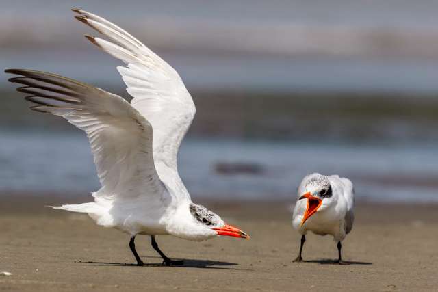
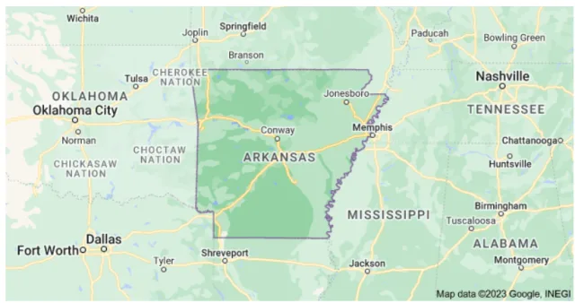
Arkansas, often called "The Natural State," is a hidden gem for birdwatchers, offering a stunning cross-section of American wildlife thanks to its diverse topography and its crucial position along the Mississippi Flyway. From the rugged, heavily forested peaks of the Ozark and Ouachita Mountains to the sprawling flatlands and rich wetlands of the Delta region, Arkansas provides essential habitats for resident birds, as well as vital resting and feeding grounds for millions of migratory species passing through in spring and fall.
The state's birding richness is perfectly exemplified by its array of protected areas. In the central lowlands, the Holla Bend National Wildlife Refuge (NWR) serves as a primary winter sanctuary, especially known for hosting tens of thousands of wintering waterfowl—including Mallards, Snow Geese, and Canada Geese—alongside a reliable population of majestic Bald Eagles. By contrast, in the northwest corner, the smaller, more wooded Lake Sequoyah near Fayetteville offers a different, but equally rewarding, experience. Here, birders focus on woodland species, wading birds like the Great Blue Heron, and the various songbirds that utilize the lake's coves and surrounding hardwood forests during the breeding season and migration. This article will explore these varied landscapes and highlight the best opportunities to connect with the abundant avian life of Arkansas.
Bald Knob NWR
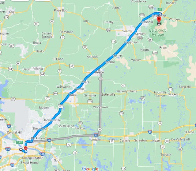
The Bald Knob National Wildlife Refuge (NWR) is centrally located in Arkansas's White County, just two miles south of the town of Bald Knob. This 15,000-acre refuge is geographically situated in the low-lying Mississippi Alluvial Valley, a region characterized by flat to gently rolling plains. The geography is dominated by a managed mix of habitats: approximately half the refuge consists of bottomland hardwood forests, including critical wetland sloughs and oxbow lakes adjacent to the Little Red River.
Uniquely, the remainder of the refuge is actively managed agricultural cropland (primarily rice, soybeans, and millet), which, through a cooperative farming program, is intentionally left partially unharvested. This creates an unparalleled mosaic of flooded fields, moist-soil units, and forests, perfectly engineered to support a massive influx of migratory birds along the Mississippi Flyway.
Bald Knob NWR’s management strategy makes it one of Arkansas's most important and reliable birding destinations, particularly from fall through winter. The refuge was established primarily to protect migratory waterfowl, and it serves as the largest staging and wintering area in the state for the Northern Pintail, with counts sometimes exceeding 200,000 birds in a single day.
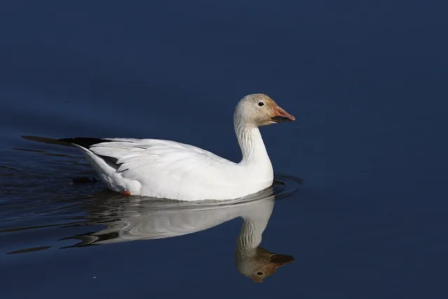
Beyond the numerous Pintails, birders are guaranteed to see large concentrations of Mallards, Snow Geese, and Greater White-fronted Geese. In the late summer and early fall, the strategically drained mudflats provide exceptional habitat for migrating shorebirds and waders, drawing species like the sought-after Roseate Spoonbill, Glossy Ibis, and Black-necked Stilt. Additionally, the presence of such vast numbers of waterfowl attracts raptors, ensuring excellent winter viewing opportunities for Bald Eagles soaring overhead or perched near the Little Red River.
Target Birds
Red-shouldered Hawk
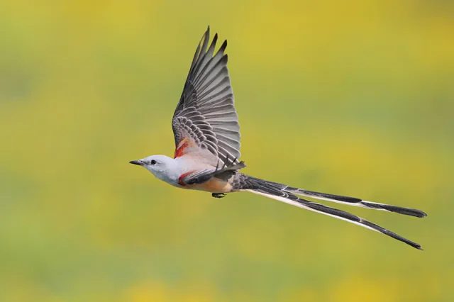
Scissor-tailed Flycatcher
Mississippi Kite
Hooded Warbler
Painted Bunting
Solitary Sandpiper
Black Tern
The U.S. Fish and Wildlife Service page for Bald Knob NWR has information for visitors.
Lake Fayetteville
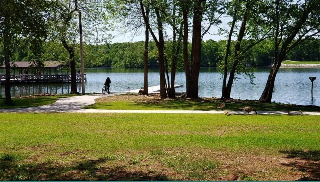
Lake Fayetteville is centrally located within Northwest Arkansas and is a key feature of the city of Fayetteville's park system. Geographically, it is situated on the Springfield Plateau of the Ozark Mountains, with the surrounding land characterized by rolling hills, oak-hickory upland forests, and bottomland areas along the shoreline of Clear Creek, which feeds the 194-acre reservoir.
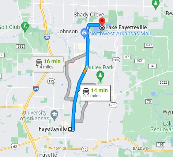
The environment is a mix of natural and developed parkland, with a dense, wooded 5.5-mile nature trail circling the lake. This blend of open water, marshy edges, and mature forest fragments creates a valuable microhabitat diversity right within an urban setting, making it one of the most accessible and productive birding locations in the region.
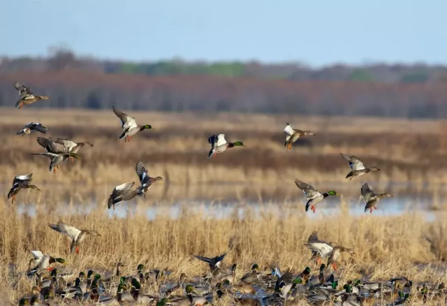
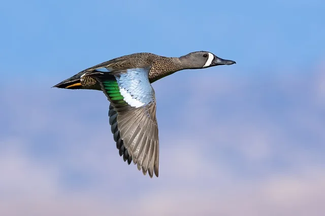
The varied habitats around Lake Fayetteville provide excellent opportunities for birding throughout the year, especially during spring and fall migration. The open water and wooded shorelines are magnets for waterfowl, with species like Northern Shovelers, Blue-winged Teal, Hooded Mergansers, and various grebes being common winter and migrant visitors.
The forests attract a high diversity of passerines, including numerous species of warblers, vireos, and tanagers during migration, and resident birds like Carolina Chickadees and Tufted Titmice. Of particular note is the Mulhollan Waterfowl Blind located on the southeastern shore, which overlooks open water and restored wetland, offering a superb vantage point for observing ducks, waders such as Great Blue Herons, and open-country species like Field Sparrows and the beautiful Painted Bunting in summer.
Target Birds
Barred Owl
Summer Tanager
Eastern Meadowlark
Bell's Vireo
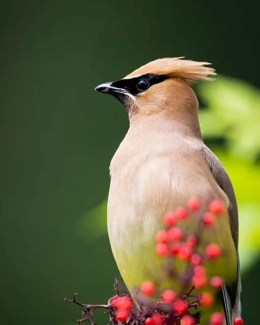
Cedar Waxwing
Alder Flycatcher
The Arkansas Audubon group has an excellent pdf with maps and trail information.
Two Rivers Park
Two Rivers Park, an expansive 1,000-acre green space, is located on the western edge of Little Rock, Arkansas, at the scenic confluence of the Arkansas River and the Little Maumelle River. This unique geographical position, where two major waterways meet, defines its diverse landscape. The park is characterized by two primary habitats: approximately 450 acres of wooded wetlands and river bottomland, and 550 acres of open fields and shrubby areas.
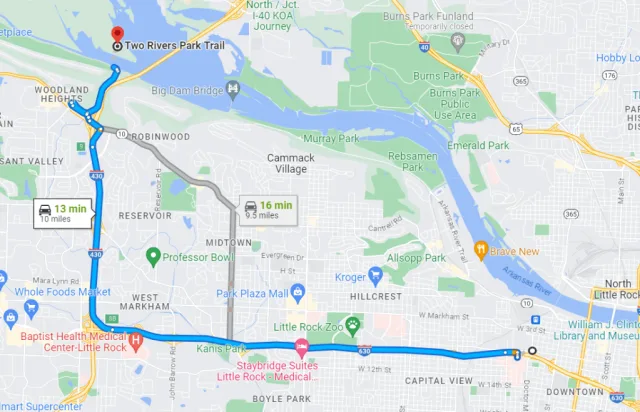
Its flat terrain, part of the Arkansas River floodplain, features well-maintained paved and natural trails, including the Two Rivers Bridge, a pedestrian/bike bridge that offers panoramic views over the rivers and wetlands. This accessibility within a metropolitan area makes it a crucial, easily-reached stop for birders in Central Arkansas.
The park’s mix of riverside, wetland, and open-field habitats provides excellent birdwatching opportunities throughout the year, with over 210 species recorded. The wooded wetlands along the Little Maumelle River are particularly productive for Prothonotary Warblers and various species of vireos and thrushes during the spring and fall migrations.
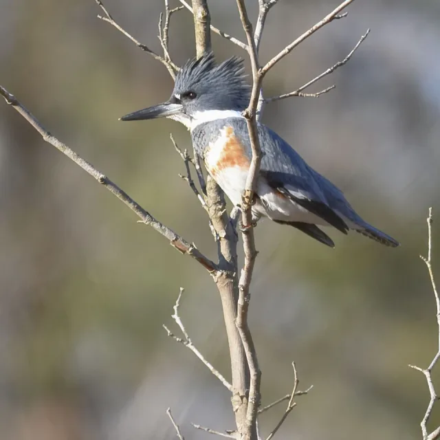
Waterbirds, including Belted Kingfishers, different species of herons and egrets, and occasionally even Bald Eagles using the Arkansas River as a travel corridor, are often observed from the bridges and shoreline. In the open fields, look for grassland and edge species like Eastern Bluebirds and various sparrows—including possible wintering rarities like Clay-colored Sparrows—while the brushy areas attract birds like Blue Grosbeaks and Yellow-breasted Chats. Two Rivers Park stands out as an urban oasis that delivers a high density and variety of species for both casual and serious birders.

Target Birds
Warbling Vireo
Pine, Blackburnian and Prothonotary Warbler
American Redstart
Dickcissel
Green Heron
Solitary and Spotted Sandpiper
The Nashville County website has access and amenity information about the park.
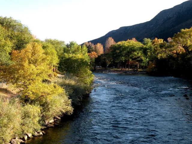
Millwood Lake
Millwood Lake is situated in the Gulf Coastal Plain of southwestern Arkansas, near the towns of Ashdown and Texarkana. The lake, formed by the longest earthen dam in the state across the Little River, covers approximately 35,000 acres, much of which is flooded timber and cypress swamp. This large reservoir and its surrounding environs—a mix of lowland bottomlands, upland hardwood forests, and marshy areas—create an extremely rich and diverse habitat.
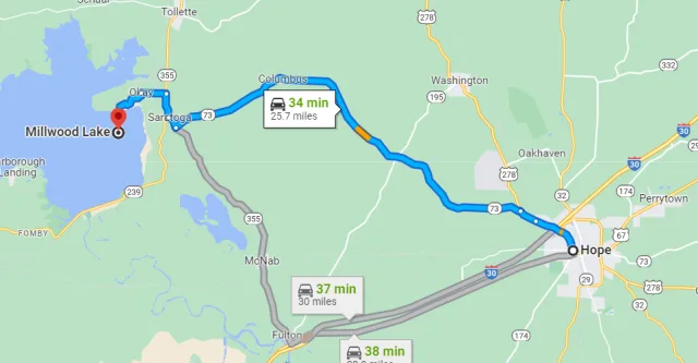
Its location places it squarely in a critical zone for both eastern and western bird species, and its status as an Important Bird Area (IBA) by the National Audubon Society is well-earned. The varied geography ensures that birders have access to distinct micro-habitats, including the open water of the main lake, the dense cover of Millwood State Park, and the unique, open viewing areas near the spillway and the Okay Levee.
With over 325 bird species recorded in the area, Millwood Lake is renowned as one of Arkansas's top birding hotspots, particularly for waterbirds and for its remarkable history of hosting rare vagrants. The submerged timber and dense cypress stands provide ideal breeding habitat for species such as the Anhinga, Tricolored Heron, White Ibis, and the striking yellow Prothonotary Warbler.
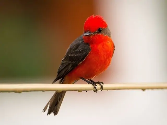
During migration and winter, the lake is an essential stopover for thousands of American White Pelicans and a high diversity of waterfowl. However, Millwood’s true fame lies in the rarities often spotted near the dam and the Okay Levee, which have produced numerous first state records including various species of gulls, all three jaegers, and land-bird rarities like Cave Swallow and Vermilion Flycatcher. Key access points like the Beard’s Bluff Overlook allow birders to scope the open water for these sought-after migrants and rarities.
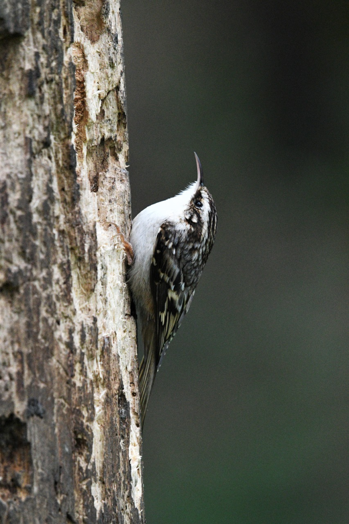
Target Birds
Snowy Egret
Fish Crow
Golden-crowned Kinglet
Brown Creeper
Black Vulture
The Arkansas State Park website has visitor information about fishing, camping and of course, birding.
Frog Bayou WMA
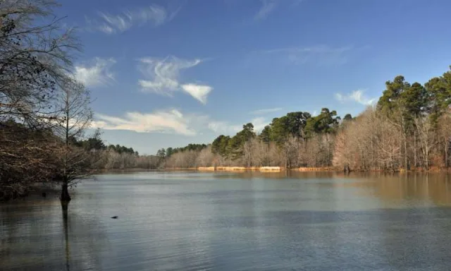
Frog Bayou Wildlife Management Area (WMA), located in Crawford County near the town of Alma, is a key wetland restoration project situated directly along the Arkansas River Valley. Historically farmland, the area has been converted into a diverse complex of moist-soil units (shallow impoundments managed for wetland vegetation), bottomland hardwood forests (with species like cypress and willow oak), and riparian areas bordering the river.
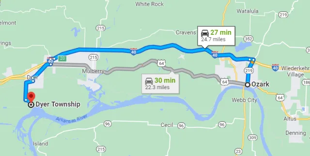
This geography places the WMA in a critical transition zone, capturing both the wetland-dependent species of the flat, flood-prone river valley and the woodland species that inhabit the bordering uplands. The WMA's approximately 2,180 acres are managed by the Arkansas Game and Fish Commission primarily to produce high-quality habitat for migratory and wintering waterfowl. Access for birding is generally excellent along the levees and public roads, making it a highly accessible destination for exploring the valley's avian life.
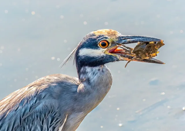
The focus on wetland restoration makes Frog Bayou WMA an outstanding location for observing waterfowl and wading birds, particularly during the non-hunting seasons when the birds are undisturbed. In late fall and winter, the moist-soil units attract thousands of ducks, including Mallards, Gadwalls, Green-winged Teal, and Wood Ducks. The area is also highly reliable for wading birds during the warmer months, with nesting and foraging species like Great Blue Heron, Great Egret, Little Blue Heron, and the often-secretive Yellow-crowned Night-Heron utilizing the shallow waters. Beyond the wetlands, the forested and scrubby riparian edges along River Road are key for songbirds.
Birders commonly find Painted Buntings singing in the summer, alongside Bell's Vireos and Yellow Warblers. Furthermore, the open areas, particularly in the vicinity of nearby sod farms and wastewater treatment plants (viewable from public roads), occasionally host sought-after rarities for the state, such as the Black-bellied Whistling-Duck, solidifying the WMA's reputation as a multifaceted birding site.

Target Birds
Yellow-billed Cuckoo
White-faced Ibis
Wilson's Phalarope
Least and Pectoral Sandpiper
Double-crested Cormorant
Long-billed Dowitcher
The Northwest Arkansas Audubon has an excellent file about the area and lots of tips about where to see the birds.
Holla Bend NWR
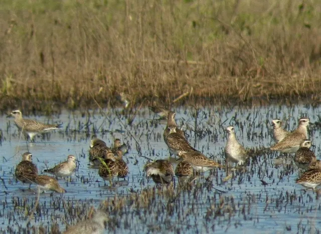
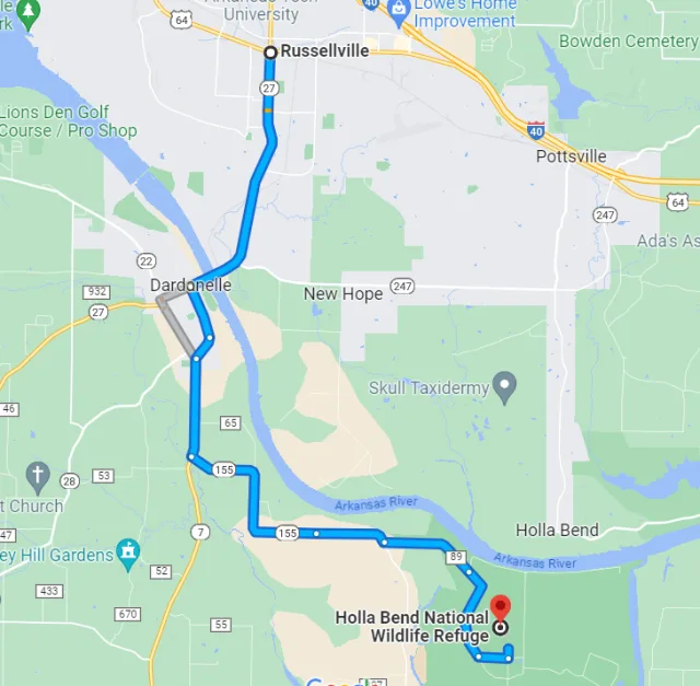
Holla Bend National Wildlife Refuge (NWR) is strategically located in the Arkansas River Valley, approximately five miles southeast of Dardanelle. Its unique geography is defined by a former meander of the Arkansas River that was cut off by the U.S. Army Corps of Engineers in 1954 to straighten the navigation channel. This intervention created an oxbow lake that now bounds the 7,000-acre refuge on three sides, isolating it from the main channel and forming a secure island of diverse habitat.
The landscape is a mosaic of agricultural fields planted with crops like corn and wheat, managed moist soil units (wetlands), and extensive stretches of bottomland hardwood forest. This combination of open feeding grounds and sheltered aquatic areas makes the refuge an indispensable staging and wintering area for migratory birds traveling the Mississippi Flyway.
The primary purpose of Holla Bend NWR is to provide a safe winter home for migratory waterfowl, and the birding opportunities during this time are spectacular. From November through February, the refuge routinely hosts up to 100,000 ducks and geese, with huge concentrations of Mallards, Snow Geese (including the "blue" phase), and Canada Geese resting in the old river channel or feeding in the fields.
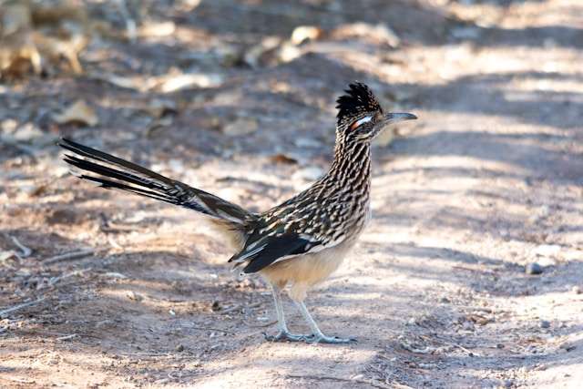
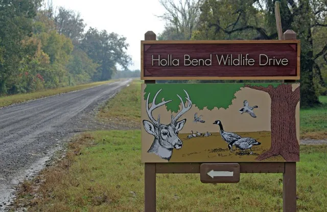
Alongside this massive waterfowl display, the refuge is famous for its concentration of raptors, particularly Bald Eagles, with a dozen or more individuals often seen perched in large trees or soaring overhead. Beyond winter, the spring and fall migrations bring numerous neotropical songbirds like warblers, vireos, and buntings, while year-round residents include Greater Roadrunners and wading birds like herons and egrets that frequent the shallow pools. The refuge's 10-mile self-guided Wildlife Drive and various trails offer excellent access for observing these seasonal highlights.

Target Birds
Northern Bobwhite
Rose-breasted Grosbeak
Northern Parula
Belted Kingfisher
Lincoln's Sparrow
Golden-winged Warbler
Blue-headed Vireo
The USFWS has visitor information about the refuge.
Cook's Landing
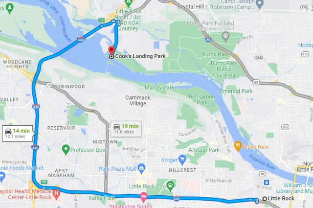
Cook's Landing, officially known as Cook's Landing Park, is situated in North Little Rock, Arkansas, along the north bank of the Arkansas River. Its strategic location is adjacent to the Murray Lock and Dam, a major feature that influences the river's flow and creates favorable conditions for avian life. Geographically, the park is part of the broader Arkansas River Valley ecoregion, characterized by bottomland habitats—a mix of woods, fields, and marsh areas right next to a significant waterway.
The park’s accessible trail system, including the Isabella Jo Trail, allows birders to easily navigate these habitats, providing excellent viewing angles of the river, the dam area, and the surrounding riparian and upland vegetation. This combination of protected riverfront and varied terrain makes it a key stopover site along the Mississippi Flyway.
The birdwatching opportunities at Cook's Landing are exceptional, with over 210 species identified at the site, making it one of the premier birding hotspots in Central Arkansas. The river and dam area are particularly attractive to waterfowl, gulls, and wading birds, especially during the winter and migration periods when species like various ducks, American White Pelicans, and gulls are common.
The park's woodland and scrub areas are crucial for migratory songbirds in the spring and fall, including various warblers, vireos, and flycatchers, which use the riverside forest as a vital refueling stop. Additionally, resident birds like Great Blue Herons, Belted Kingfishers, and numerous woodpeckers, including the Pileated Woodpecker, are present year-round, ensuring a rewarding birding experience regardless of the season.
Target Birds
Least Tern
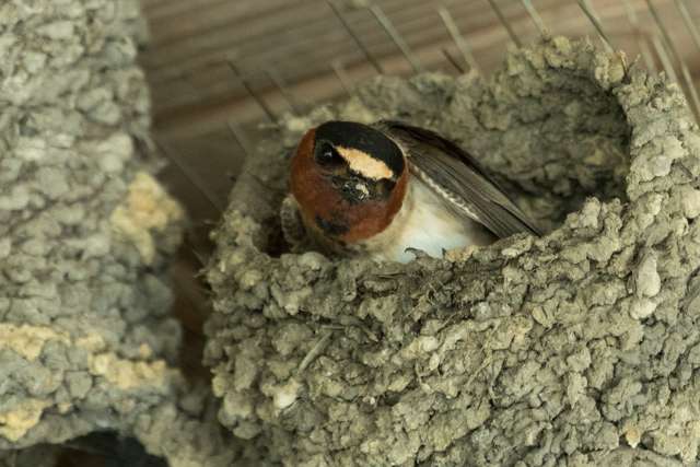
Cliff Swallow
Sedge Wren
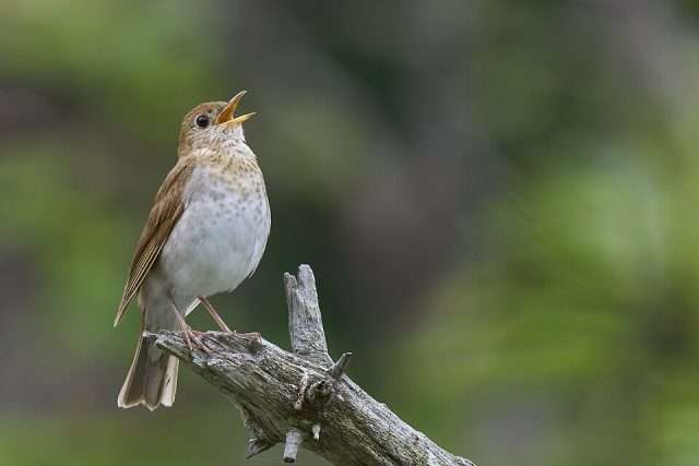
Veery
Chestnut-sided Warbler
- Lesser Scaup
The Audubon Society of Central Arkansas includes a reference to Cook's Landing as well as other hotspots in the area.
Lake Sequoyah
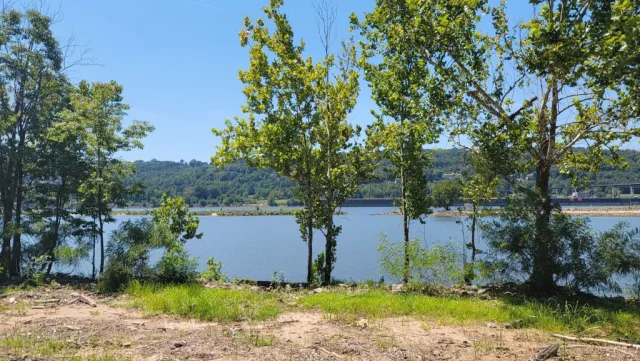
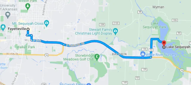
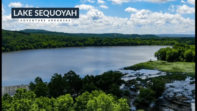
Lake Sequoyah is a modest, 424-acre reservoir situated in the rolling foothills of the Ozark Mountains in Washington County, Northwest Arkansas, lying just southeast of the city of Fayetteville. Geographically, it was formed by impounding the Middle Fork of the White River and is characterized by a long, narrow main body with wooded coves and a shoreline dominated by dense upland hardwood forests.
The local topography transitions from gentle slopes near the water to more rugged terrain further out, creating a valuable mosaic of habitats. This proximity to a major metropolitan area, combined with a network of accessible nature trails—such as the Kingfisher Trail and Rookery Trail—makes Lake Sequoyah a convenient and reliable destination for birding in the Ozarks region.
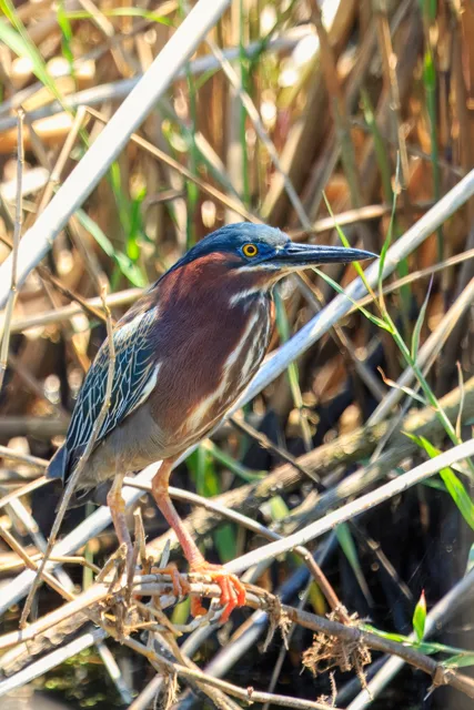
The diverse habitats surrounding Lake Sequoyah, including open water, marshy back sloughs, forest edge, and deep woods, offer excellent birding opportunities throughout the year, especially during migration. The lake is a dependable location for viewing wading birds like the Great Blue Heron and Green Heron, which utilize the shallow coves for feeding.
Winter birders often scan the open water for Bald Eagles perched on the south side of the lake, along with wintering waterfowl like various ducks, grebes, and cormorants. In the surrounding woodlands, observers can find numerous songbirds, particularly during the spring and fall migrations. The woods below the dam are known to host species such as the Painted Bunting, Hooded Warbler, and the strikingly colored Prothonotary Warbler during the nesting season, cementing Lake Sequoyah's reputation as a key spot for viewing both water and woodland birds in Northwest Arkansas.
Target Birds
Hooded Merganser
Killdeer
Canada Warbler
Common Nighthawk
White-rumped Sandpiper
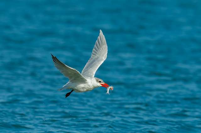
- Caspian Tern
The Fayetteville.gov has good visitor information on its website.
Beaverfork Lake
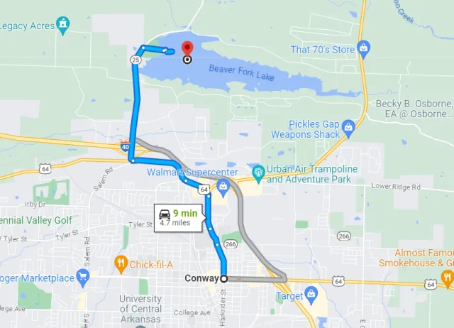
Beaverfork Lake is situated just north of the city of Conway in Central Arkansas, placing it in a transitional zone between the flatlands of the Mississippi Alluvial Plain and the rolling foothills of the Ouachita Mountains. The 960-acre reservoir, created primarily as a drinking water source for Conway, is surrounded by a large city park spanning approximately 1,200 acres.
The geography here is marked by gentle slopes and a mix of mature hardwood and pine forest, offering an important pocket of natural habitat amid urban development. This blend of open water, wooded shores, and surrounding parkland—complete with trails and recreational facilities—makes the area easily accessible for a quick but rewarding birding session.
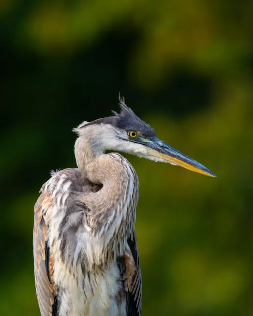
The convergence of lake, forest, and human infrastructure creates diverse birdwatching opportunities throughout the year. As a major body of open water, Beaverfork Lake attracts various waterfowl, especially during migration and in winter. You can often spot Great Blue Herons and Belted Kingfishers along the shorelines, while migrating ducks and loons utilize the deeper water for resting.
The surrounding woods are excellent for observing woodland species typical of the region, including various woodpeckers, Brown-headed Nuthatches, and a range of warblers and vireos passing through in spring and fall. The site is particularly well-regarded for providing easy viewing access to both aquatic and terrestrial species, and the well-maintained park facilities ensure a comfortable experience for birders of all skill levels.

Target Birds
Forster's Tern
Black-bellied Whistling Duck
Osprey
Willet
Great Northern Diver
- Broad-winged Hawk
The Central Arkansas website has lots of information about accessing the lake and its amenities.
Wapanocca NWR
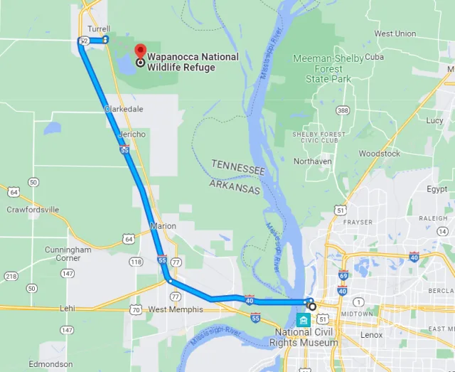
The Wapanocca National Wildlife Refuge (NWR) is a crucial 5,484-acre sanctuary nestled in Crittenden County, Arkansas, only about 20 miles northwest of Memphis, Tennessee, and four miles west of the mighty Mississippi River. Geographically, it is located within the Arkansas Delta, a region characterized by flat, fertile floodplains extensively converted to agriculture. Wapanocca, therefore, stands as a critical wildlife oasis within this intensely farmed landscape.
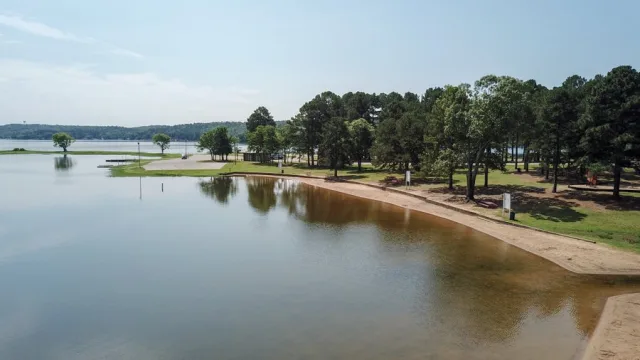
Its geography is dominated by Wapanocca Lake, a 600-acre oxbow lake—a remnant of a former bend in the Mississippi River—which is ringed by a globally significant bald cypress/willow swamp. The refuge also features extensive tracts of reforested and mature bottomland hardwood forest and seasonally-managed agricultural lands, all protected from the main river by the Mississippi River levee system.
The refuge’s diverse mosaic of habitats and its strategic position in the heart of the Mississippi Flyway make it an exceptional birdwatching site, hosting over 260 recorded species. Wapanocca was originally established in 1961 primarily to serve as a vital wintering ground and inviolate sanctuary for migratory waterfowl. During the winter, the lake and managed impoundments teem with thousands of ducks, including Mallards, Gadwall, and Northern Pintails. However, Wapanocca is perhaps most compelling during the spring and fall migrations.

The bottomland hardwood forest and swampy edges act as a key stopover for a spectacular diversity of neotropical songbirds, including 36 species of warblers, such as the sought-after Prothonotary Warbler which nests in the cypress swamps, and various vireos and flycatchers. Furthermore, the refuge supports a large rookery for wading birds like Great Blue Herons and Great Egrets, and it is a reliable nesting spot for the majestic Bald Eagle, making it a year-round destination for avian enthusiasts.
Target Birds
Green Heron
Olive-sided and Acadian Flycatcher
Purple Martin
Eastern Towhee
Bobolink
Black and White and Swainson's Warbler
- Bobolink
The USFWS webpage for this NWR has up to date access information for visitoris.
Wrapping Up
Arkansas truly earns its moniker as "The Natural State" for the incredible variety and abundance of its avian life. From the dense bottomland hardwoods of Wapanocca NWR and the crucial wintering grounds of Holla Bend NWR, to the forested coves of Lake Sequoyah and the high-elevation forests of the Ozarks, the state offers a unique tapestry of habitats that support over 400 species annually. For the birdwatcher, this diversity translates into the thrill of spotting a Prothonotary Warbler in a cypress swamp one day and locating a nesting Bald Eagle the next.
More than just a destination, Arkansas represents a vital bottleneck in the Mississippi Flyway, funneling millions of migratory birds—especially waterfowl—through its wetlands and river valleys each winter and spring. This crucial geographical role places an immense responsibility on the state's conservation efforts. Organizations like Audubon Delta and the Ozark Bird Conservancy, alongside the dedicated staff of the National Wildlife Refuges, work tirelessly to manage and restore habitat against challenges like climate change and habitat loss. The opportunity to birdwatch in Arkansas is, therefore, also an opportunity to be a citizen scientist and a conservation advocate. By visiting these key sites, every birder contributes to the appreciation and protection of the fragile ecosystems that ensure the spectacular passage of wings continues for generations to come.
