
The annual spectacle of bird migration across the United States is one of the continent's most profound natural events. Driven by instinct, daylight cues, and the search for food, billions of birds embark on epic journeys spanning thousands of miles between their breeding and wintering grounds. Crucial to this immense movement are the flyways: established, superhighways of the sky that funnel these migrants along the most energetically efficient routes.
In this post, we explore the concept of bird flyways, detailing what they are, outlining the four primary North American flyways that crisscross the U.S., and highlighting some of the diverse array of species that rely on them for their survival.
What Are Bird Flyways?
A flyway is essentially a migratory route of an entire population of birds between its breeding grounds and its wintering areas. They are vast, traditional corridors that have been etched into avian behavior over millennia, shaped by geographical features and climate.
Flyways are not narrow, fixed lines in the sky. Instead, they are broad geographical zones—sometimes hundreds of miles wide—that encompass numerous environmental features like mountain ranges, coastlines, and major river systems. These features serve two crucial purposes:
- Guidance: Features like the Atlantic coastline or the Rocky Mountains act as natural leading lines, helping birds navigate with minimal deviation.
- Resource Provision: Flyways are rich in stopover sites—patches of habitat like coastal marshes, forest fragments, or prairie wetlands—where birds can rest, refuel, and wait out bad weather before continuing their journey. Without these strategically located resources, migration would be impossible for many species.
In North America, scientists and conservationists recognize four major flyways that channel most of the migratory bird traffic across the continent, covering the breadth of the United States.
The Four Major North American Flyways

The four primary flyways are generally oriented in a north-south direction, originating in the breeding grounds of Canada and the northern U.S. and terminating in the wintering grounds of the southern U.S., Central America, and South America.
1. The Atlantic Flyway
- Location: This flyway follows the Atlantic coastline, running from the northeastern U.S. and eastern Canada down to the Gulf of Mexico and the Caribbean. It encompasses the states from Maine to Florida, including the entire Appalachia region.
- Geographical Features: The coast is the dominant feature, providing vital salt marsh and barrier island habitats for stopovers. Inland, birds utilize the Appalachian Mountain ridges for lift (ridge soaring).
- Key Stopover Sites:
- Cape May, New Jersey: An iconic funnel point where raptors and songbirds congregate before crossing or skirting the Delaware Bay.
- Outer Banks, North Carolina: Critical for shorebirds and waterfowl.
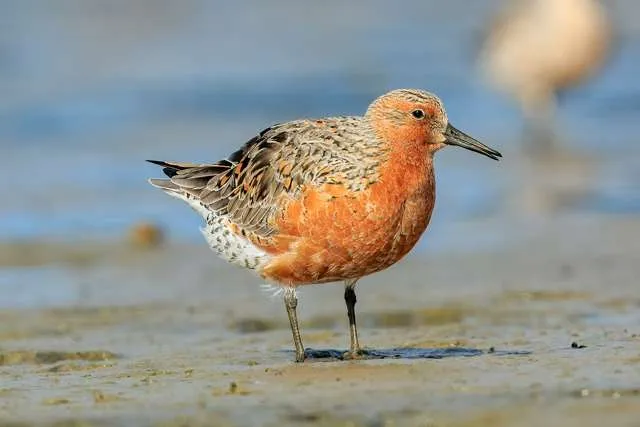
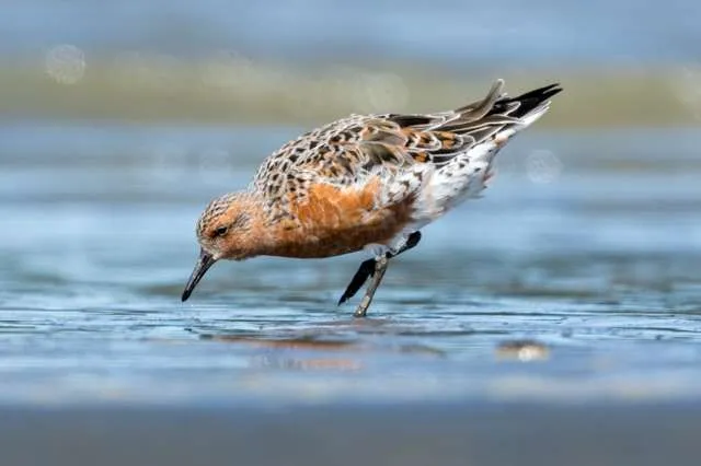
- Delaware Bay (DE/NJ): Famed for the massive congregations of Red Knots that stop to feed on Horseshoe Crab eggs in late spring.
- Birds That Use It:
- Waterfowl: Brant Geese, Black Ducks, and various scoters.
- Shorebirds: Red Knots, Sanderlings, and Piping Plovers.
- Raptors: Broad-winged Hawks and Sharp-shinned Hawks (especially along the mountain ridges).
- Passerines: Warblers and vireos traveling through coastal forests and barrier islands.
2. The Mississippi Flyway
- Location: The continent's most heavily used flyway, running the length of the U.S. interior, tracing the path of the Mississippi River from the Great Lakes region down to the Gulf Coast of Louisiana and Texas.
- Geographical Features: The Mississippi River Valley is the primary corridor, providing a continuous chain of wetlands, floodplains, and riparian forests for food and shelter.
- Key Stopover Sites:
- Great River Road (Midwest): Hundreds of miles of protected lands along the river.
- Horicon Marsh, Wisconsin: One of the largest freshwater marshes in the U.S., hosting hundreds of thousands of waterfowl.
- White River National Wildlife Refuge, Arkansas: Critical wintering ground for mallards and other ducks.
- Birds That Use It:
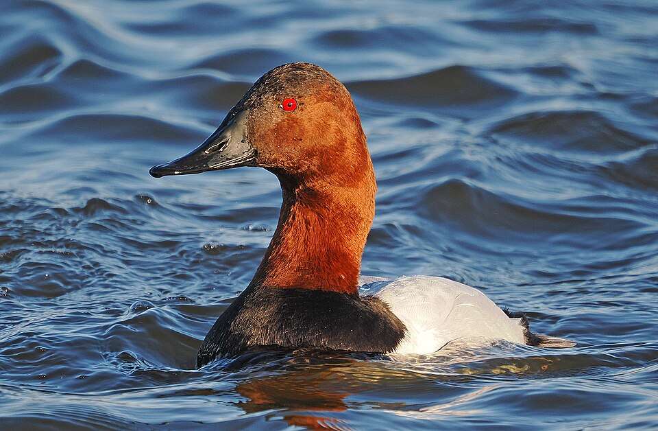
- Waterfowl: The undisputed king of this flyway, including the majority of the continent's Mallards, Wood Ducks, Northern Pintails, and Canvasbacks.
- Wading Birds: Great Egrets and Great Blue Herons.
- Cranes: The entire population of Sandhill Cranes (except the Pacific population) and the rare Whooping Crane use this corridor.
- Passerines: Virtually all eastern-breeding warblers, thrushes, and orioles use this route due to the rich habitat of the river valley.
3. The Central Flyway
- Location: A broad, arid route that spans the Great Plains, stretching from the central Canadian provinces through the Dakotas, Nebraska, Kansas, Oklahoma, and Texas, down to Mexico.
- Geographical Features: Dominated by grasslands, prairies, and the semi-arid high plains. It relies heavily on wetland complexes created by river systems like the Platte and tributaries of the Rio Grande.
- Key Stopover Sites:
- Platte River, Nebraska: Famous for hosting over 500,000 Sandhill Cranes and numerous waterfowl in the spring.
- Cheyenne Bottoms, Kansas: A large inland marsh critical for shorebirds migrating across the arid landscape.
- Bosque del Apache NWR, New Mexico: A vital wintering location, especially for Snow Geese and Sandhill Cranes.
- Birds That Use It:
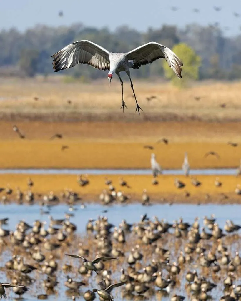
- Cranes: The spectacular Sandhill Cranes utilize this flyway in massive numbers.
- Waterfowl: Key populations of Greater White-fronted Geese and Snow Geese.
- Shorebirds: Many species stop at inland prairie potholes, including Long-billed Curlews and American Avocets.
- Raptors: Highly utilized by Ferruginous Hawks and other raptors that follow the thermal-generating plains.
4. The Pacific Flyway
- Location: Follows the Pacific coastline, from Alaska and western Canada through the western U.S. states (Washington, Oregon, California) and down into Mexico.
- Geographical Features: The route is defined by the high, rugged Pacific Coast Mountain Ranges and major valleys, most notably the Central Valley of California.
- Key Stopover Sites:
- Copper River Delta, Alaska: A crucial refueling site for millions of shorebirds (e.g., Western Sandpipers) coming from the Arctic.
- Grays Harbor, Washington: Another major shorebird concentration area.
- Klamath Basin (OR/CA): One of the most important waterfowl staging areas in North America, hosting millions of ducks and geese.
- Central Valley, California: A massive wetland and agricultural mosaic that supports a majority of the flyway's wintering waterfowl.
- Birds That Use It:
- Waterfowl: The vast majority of Tundra Swans and Dusky Canada Geese.
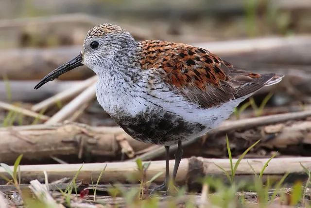
- Shorebirds: Immense flocks of Western Sandpipers and Dunlin.
- Pelagic Birds: Various seabirds follow the coastline.
- Endemic Western Birds: Many western songbird populations, including Western Tanagers and Varied Thrushes, use the coastal valleys.
The Critical Importance of Flyways
The flyways are more than just routes; they are the lifeblood of bird conservation. The health of a migratory bird population depends entirely on the health of the entire flyway, from the northernmost breeding ground to the southernmost wintering site.
- Conservation Management: Recognizing the four flyways allows for cooperative conservation efforts between states, provinces, and countries. Organizations and government agencies coordinate resource protection across the entire migratory range, rather than focusing only on a single area.
- Threats: The biggest threats to the flyways are habitat loss at stopover sites (due to urban expansion and agricultural conversion) and climate change, which can disrupt the timing of migration relative to food availability. When a stopover site is lost, birds must fly further, exhausting their limited energy reserves and dramatically reducing their chances of survival.
- Avian Disease Monitoring: The flyways are also crucial for monitoring the spread of avian diseases, such as avian influenza, as they allow scientists to track the movement of potentially infected populations across large distances.
Wrapping Up
The flyways are one of the U.S.'s greatest natural treasures. They underscore the interconnectedness of landscapes across the continent and highlight the urgent need for trans-border cooperation. For the millions of birds that depend on them, these ancient aerial superhighways are quite literally the routes to survival.
